[vc_row][vc_column][/vc_column][/vc_row][vc_row full_height=”yes” equal_height=”yes”][vc_column] The Phantom 4 RTK SDK package is essentially the same as the market leading Phantom 4 RTK except that it includes the Phantom 4 RTK SDK Remote Controller without screen. In addition to supporting Ground Station Pro, pilots with experience using 3rd party applications on DJI drones are able to access the world’s leading drone app ecosystem for their Phantom 4 RTK with the SDK remote controller. Users can plug in a compatible Android or iOS device and install any compatible DJI Mobile SDK-enabled app to harness the full power of their Phantom 4 RTK The ultra-compact and lightweight thermal drone solution dedicated to all professionals. ANAFI Thermal is a thermal imaging drone is easy to use, lightweight and powerful. The drone’s unique imaging capabilities enable you to take immediate action or analyze recorded photos and videos in unprecedented detail. ANAFI Thermal is designed to profoundly revolutionise the way many industries and trades operate, offering professionals a complete solution that adapts perfectly to their requirements and needs. ANAFI Thermal: • Weighs only 315g and has a unique foldable design meaning you always have it to hand The ultimate platform for aerial productivity combines a rugged design and simple configurability to work as a solution for a variety of industrial applications. Improvements to the M200 Series V2 enhance intelligent control systems, flight performance, and add flight safety and data security features. Multi-sensor payloads that bring a whole new meaning to mission efficiency. The unique intelligence and integrated design provide unprecedented aerial imaging capabilities for a range of commercial drone applications. IP44 Rating YUNTYHBEU Typhoon H is an advanced aerial photography and videography platform available in such a compact size. Driven by customer demand for a design that goes beyond the limitations of a traditional quadcopter, Typhoon H delivers capabilities previously only found in high-end professional offerings, but at a consumer price. ANAFI Work is an ultra compact tool for professionals, helping them make informed decisions using the drone’s aerial insights. •ANAFI Work includes the advanced ANAFI drone equipped with an innovative imaging system, a 4K/21MP camera with a 180° vertical orientation, allowing you to easily capture images of inaccessible areas. •ANAFI Work is the perfect on-the-go tool that is ready-to-fly in no time. The drone operates for 1 hour and 40 minutes with its 4 USB-C smart batteries. •This Parrot drone solution can easily be transported anywhere in its compact shoulder bag. •ANAFI Work allows professionals to create 3D models of buildings, quickly and easily, using the one year free access to Pix4Dmodel. Parrot Bluegrass Fields is a comprehensive, ready-to-fly drone solution that spans the entire crop analysis workflow. Parrot Bluegrass Fields provides agriculture professionals with the insights they need to maximize their yields and boost the quality of their crops. • The rugged, easy-to-fly Parrot Bluegrass drone The Zenmuse Z30 is the most powerful integrated aerial zoom camera on the market with 30x optical and 6x digital zoom for a total magnification up to 180x. Whether you are inspecting power lines, cell towers or wind turbines, it enables you to get a detailed look at structures, wires, modules and components to detect damage. With the Z30’s incredible zoom capabilities you can avoid any potential electro-magnetic or RF intereference associated with utilities and communications infrastructure. This camera can only be used on the M100, M600 and M200 series airframes and is not compatible with the Inspire 1 or Inspire 2. The all-weather, multi-sensor flagship Zenmuse H30 Series integrates five major modules—a wide-angle camera, a zoom camera, an infrared thermal camera, a laser range finder, and an NIR auxiliary light. Employing cutting-edge intelligent algorithms, it revolutionizes perception and imaging standards, transcending the limitations of day and night vision. This makes it effortlessly suitable for a variety of operations, including public safety, energy inspection, water conservation, and forestry. The all-weather, multi-sensor flagship Zenmuse H30 Series integrates five major modules—a wide-angle camera, a zoom camera, an infrared thermal camera, a laser range finder, and an NIR auxiliary light. Employing cutting-edge intelligent algorithms, it revolutionizes perception and imaging standards, transcending the limitations of day and night vision. This makes it effortlessly suitable for a variety of operations, including public safety, energy inspection, water conservation, and forestry. The all-weather, multi-sensor flagship Zenmuse H30 Series integrates five major modules—a wide-angle camera, a zoom camera, an infrared thermal camera, a laser range finder, and an NIR auxiliary light. Employing cutting-edge intelligent algorithms, it revolutionizes perception and imaging standards, transcending the limitations of day and night vision. This makes it effortlessly suitable for a variety of operations, including public safety, energy inspection, water conservation, and forestry. The all-weather, multi-sensor flagship Zenmuse H30 Series integrates five major modules—a wide-angle camera, a zoom camera, an infrared thermal camera, a laser range finder, and an NIR auxiliary light. Employing cutting-edge intelligent algorithms, it revolutionizes perception and imaging standards, transcending the limitations of day and night vision. This makes it effortlessly suitable for a variety of operations, including public safety, energy inspection, water conservation, and forestry.ENTERPRISE
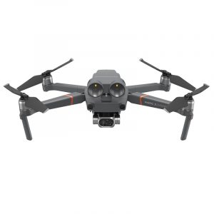
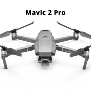
DJI Mavic 2 Enterprise Dual with Smart Controller
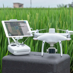
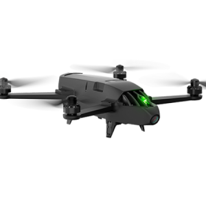
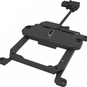
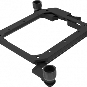
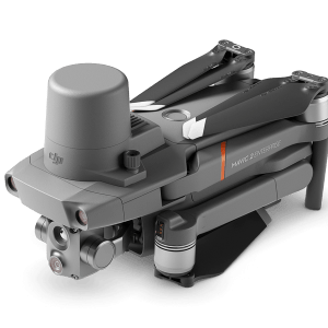
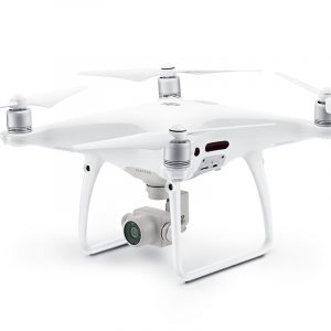
DJI Phantom 4 Multispectral
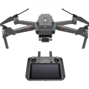
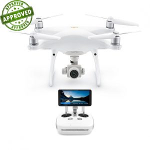
DJI Phantom 4 RTK SDK
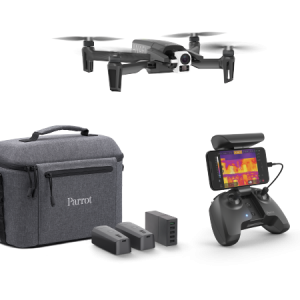
Parrot Anafi Thermal
• 2 cameras: Thermal FLIR® and 4K HDR with 21MP Sony sensor. Stabilised on 3 axes, they tilt at +/-90° to observe right underneath structures
• A powerful and reliable drone that offers up to 78 min of cumulative flight (3 batteries)
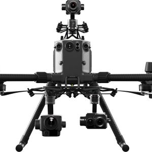
• Easy to use thanks to the FreeFlight 6 app, giving you control of all the flight parametersDJI Matrice 210 V2
DJI Mavic 2 Enterprise Dual Universal Edition
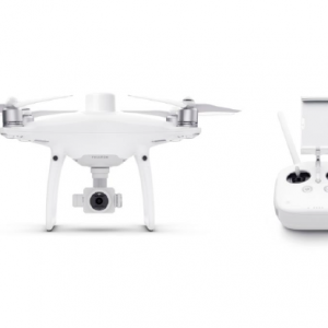
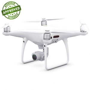
DJI Phantom 4 RTK Quadcopter with D-RTK 2 GNSS Mobile Station Combo
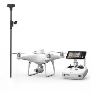
DJI Phantom 4 RTK Quadcopter with D-RTK 2 GNSS Mobile Station Combo
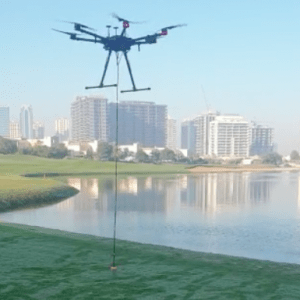
Bathymetric Drone (Airborne Bathymetric Survey)
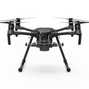
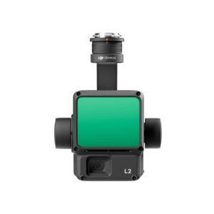
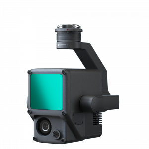
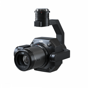
DJI Zenmuse H20 Triple Sensor
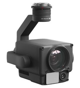
DJI Zenmuse H20 Triple Sensor
-20°C to 50°C Operating Temperature
Night Scene Mode
Active Image Stabilization and EIS
12 MP Wide Camera
82.9° DFOV
20 MP Zoom Camera
23× Hybrid Optical Zoom
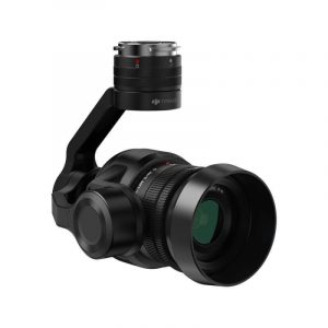
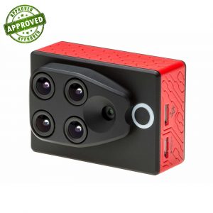
Laser Rangefinder 1200 mDJI FLIR Zenmuse XT 640×512 9Hz Performance
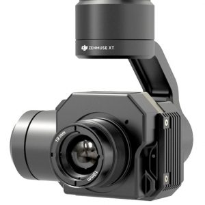
DJI FLIR Zenmuse XT 640×512 9Hz Performance
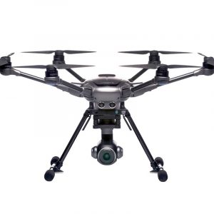
Yuneec Typhoon H
Parrot Anafi Work
Parrot Bluegrass Fields
• The industry-leading Parrot Sequoia multispectral sensor and a 14 MP front RGB camera
• ParrotFields mobile app to simplify the entire in-field workflow (one-year subscription)
• A full access to Pix4Dfields desktop and cloud software for further in-depth analysis of crop data gathered (one-year subscription)DJI Zenmuse Z30 – 30x Optical Zoom Camera/Gimbal
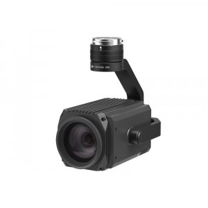
DJI Zenmuse Z30 – 30x Optical Zoom Camera/Gimbal
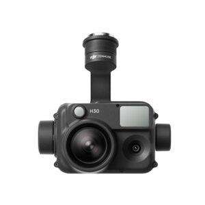
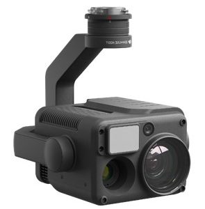
DJI Zenmuse H30T
DJI Zenmuse H30
DJI Zenmuse H30T
DJI Zenmuse H30
Premium Products for Professionals
Products Grid


Trending Products
Go to Trending Products
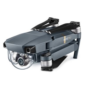
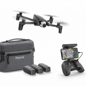
DJI Mavic Pro Fly More Combo
Soar to speeds up to 65km/h with the incredibly lightweight and amazingly equipped DJI MAVIC Pro drone. Weighing just 743g and folds up to about the size of a water bottle. Equipped with Front Obstacle Avoidance and Active Tracking functions, it features a 4K UHD camera on a 3-axis gimbal. It comes with 2 extra batteries, a car charger, and shoudler bag.
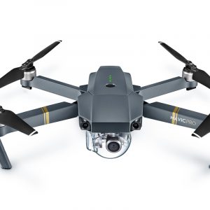
DJI Mavic Pro
The DJI Mavic Pro folds down as small as a bottle of water, making it small enough to bring with you everywhere.
New OcuSync transmission system offers up to 4.3 miles (7km) of transmission range.
Fly at up to 40mph (64kmh) or for as long as 27-minutes.
True 4K, fully stabilized ensures smooth footage
ActiveTrack, TapFly and other smart features make professional looking video effortless.
Obstacle Avoidance combined with sensor redundancy increases flight safety and reliability.
Vision positioning paired with GPS and GLONASS ensures precise positioning indoor and outdoors.
Fly by Phone over Wi-Fi for even easier flight
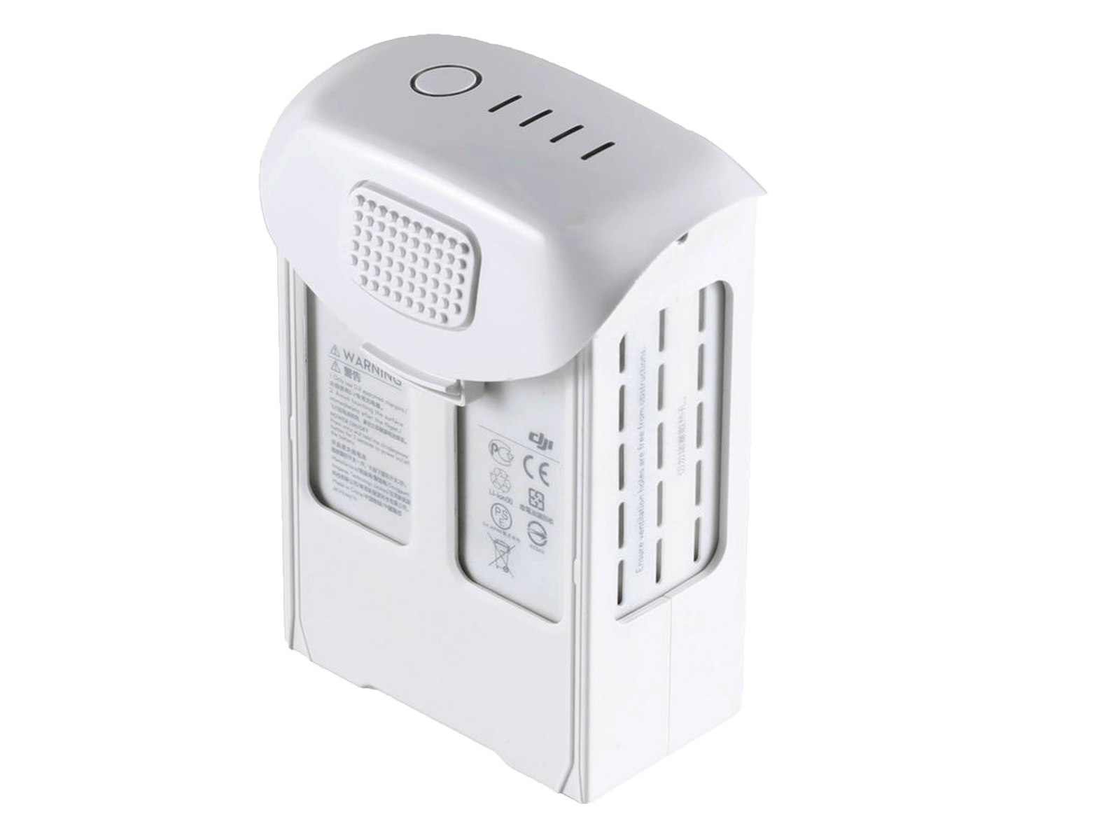
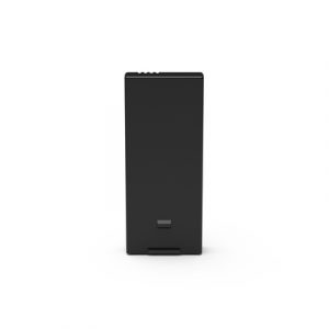
DJI Mavic Pro- Intelligent Flight Battery
Max 27-min flight time. The Mavic Intelligent Flight Batteries give it a flight time of up to 27 minutes.
It adopts the latest technologies to ensure that the flight control system is able to obtain accurate battery level. This allows it to calculate remaining flight times more accurately. It also gives pilots a full understanding of the overall battery status, including real-time battery cell status, circle number, temperature and more, and all in the DJI GO app. As well as monitoring the battery status during flight, the BMS also has overcharge and over discharge protection, reducing the likelihood of battery damage. When not in use for extended periods of time, DJI Intelligent Flight Battery automatically discharges to 50% charge, keeping it at an optimum charge level for extended battery life. When flying in cold temperatures, the BMS will activate low-temperature protection and will control power output according to the temperature. This ensures the battery can provide adequate propulsion without damage from the cold.
REFURBISHED PRODUCTS
DJI Phantom 3 Standard (Certified Refurbished)
DJI Mavic Pro (Certified Refurbished) with FREE Shoulder Bag
The DJI Mavic Pro folds down as small as a bottle of water, making it small enough to bring with you everywhere.
New OcuSync transmission system offers up to 4.3 miles (7km) of transmission range.
Fly at up to 40mph (64kmh) or for as long as 27-minutes.
True 4K, fully stabilized ensures smooth footage
ActiveTrack, TapFly and other smart features make professional looking video effortless.
Obstacle Avoidance combined with sensor redundancy increases flight safety and reliability.
Vision positioning paired with GPS and GLONASS ensures precise positioning indoor and outdoors.
Fly by Phone over Wi-Fi for even easier flight
DJI Phantom 4 Pro (Certified Refurbished)
All-new DJI Phantom camera with 1-inch 20MP Exmor R CMOS sensor, longer flight time and smarter features.
Flight time: 30 mins. Control range: 7 km. Speed: km/h. Video resolution: 4K 60fps. Sensor range: 30m. Obstacle sensing:5 direction.
DJI Phantom 3 Advanced (Certified Refurbished)
DJI Inspire 2 (Certified Refurbished)
Image quality, power and intelligence to meet the needs of professional filmmakers and enterprises around the globe.
Flight time: 25-27 mins. Control range: 7 km, Speed: 108 km/h. Video resolution: 5.2K/4K. Sensory range: 30M. Live view: 1080 p.
BIG SALE
DJI Matrice 600 Series – TB 48S Intelligent Flight Battery APPROVED USED
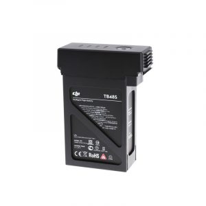
DJI Matrice 600 Series – TB 48S Intelligent Flight Battery APPROVED USED
22.8V battery that comes with charge and discharge management. New and powerful embedded battery cells provide power to the aircraft during flight. Charge using the DJI standard charger or battery charging hub.
DJI Phantom 4 Pro Plus APPROVED USED
DJI Phantom 4 Pro V1 APPROVED USED
An uprated camera is equipped with a 1-inch 20-megapixel sensor capable of shooting 4K/60fps video and Burst Mode stills at 14 fps.The adoption of titanium alloy and magnesium alloy construction increases the rigidity of the airframe and reduces weight, making the Phantom 4 Pro similar in weight to the Phantom 4. The FlightAutonomy system adds dual rear vision sensors and infrared sensing systems for a total of 5-direction of obstacle sensing and 4-direction of obstacle avoidance.
Parrot SEQUOIA+ Multispectral Sensor APPROVED USED
Parrot SEQUOIA+ Multispectral Sensor APPROVED USED
The Parrot Sequoia is a multispectral camera specifically designed to be compatible with all types of UAVs/Drones. This multispectral drone camera offers a comprehensive solution to precision agriculture, utilising it’s two sensors – multispectral and sunshine – to analyse plant vitality by capturing the amount of light they absorb and reflect. This data can then be used to to provide invaluable information to farmers, so they can do what’s best for their fields.

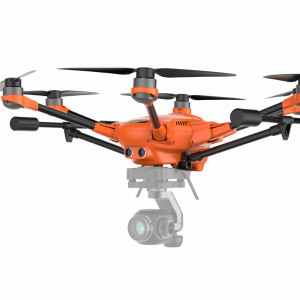
Yuneec Typhoon H Pro with Backpack
YUNTYHBPEU
Typhoon H is an advanced aerial photography and videography platform available in such a compact size. Driven by customer demand for a design that goes beyond the limitations of a traditional quadcopter, Typhoon H delivers capabilities previously only found in high-end professional offerings, but at a consumer price. Typhoon H offers flight durations of up to 25 minutes while filming with the CGO3+ 4K UHD camera. The Android powered ST16 Ground Station features a 7-inch touchscreen that displays live footage of your flight in HD 720p resolution and enables a wide variety of autonomous flight modes.
Yuneec Typhoon H
YUNTYHBEU
Typhoon H is an advanced aerial photography and videography platform available in such a compact size. Driven by customer demand for a design that goes beyond the limitations of a traditional quadcopter, Typhoon H delivers capabilities previously only found in high-end professional offerings, but at a consumer price.
SOFTWARE
DJI FlightHub 2
FlightHub 2 is an all-in-one cloud-based drone operations management platform that helps you achieve comprehensive, real-time situational awareness. Access all the information you need to plan drone missions, supervise your fleet, and manage the data you create, now from a secure cloud-based environment.

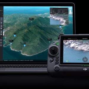
UgCS Enterprise
Live Video Feed Features
All the features and benefits of UgCS Pro.
Benefit from a live video stream from UgCS for DJI to UgCS
(currently compatible only with Win & Android)
UgCS Expert LIDAR Toolset
The UgCS LIDAR toolset unlocks the full potential of LIDARs enabling effective remote sensing without human error. Delivers everything that UgCS Pro delivers plus LIDAR capabilities.
Supports most popular LIDAR platforms: DJI, YellowScan, Riegl, PhoenixLIDAR, LIDAR USA, GeoCue, Rock Robotics, & GeoSun LIDAR
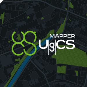
UgCS Mapper
Create Maps offline with UAV Drone Photogrammetry
Mapper is a lightweight software tool for making 2D maps and elevation out of drone imagery and video – purely offline.
Increase surveying productivity – validate the quality of dataset – collected images are suitable for map stitching, before leaving the survey area.
Higher flight safety – create up to date 3D map and elevation data, i.e., when default map sources are not accurate enough for safe mission planning.
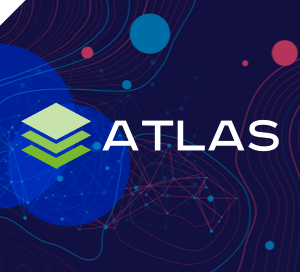
UgCS ATLAS AI
ATLAS Optimses Drone & Satellite Geospatial Data Analysis
ATLAS leverages AI to automate time-consuming manual analysis of UAV & Satellite data, such as object counting, volume measurements, making a true DTM, and much more.
ATLAS contains its own AI-engine, which learns from users activity and automates regular data analysis tasks.
ATLAS can be taught to identify changes of assets, components, and geospatial data over time, to support various monitoring, inspection, and integrity activities.

Drone Show Software
Full Turnkey Solution
Drone Show Software provides tools to manage astonishing outdoor shows by controlling up to thousands of drones as flying pixels.
This drone system by SPH Engineering is the very first commercially available software that manages its flights with lights, fireworks, smoke generators, and any other payloads.
Drone Show Software allows anyone with drones, ambition and a choreographer to create mind-blowing drone shows.
Take your events to the next level with revolutionary drone show control software which is already highly valued in many entertainment industries.
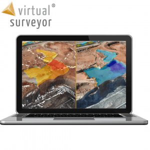
Virtual Surveyor
SMART DRONE SURVEYING SOFTWARE. SURVEY EFFICIENTLY WITH DRONE DATA
Powerful analysis and visualisation of your drone surveys. Virtual Surveyor is ideal for civil construction, infrastructure, mining and quarrying projects of any size. From road surveying to topography mapping, volume calculations and cut/fill mapping, Virtual Surveyor gives you the tools to quickly and accurately track and optimise your project as it takes shape.
Aeromotus — Online Drone Store in Dubai, UAE.
Aeromotus has a wide range of DJI drones and UAV’s of Yuneec company, SenseFly, Parrot, MicaSense etc. Fast delivery, quality service, professional advice, drone repair service.
Aeromotus UAVT can support you with the following:
- Drones for 3D Mapping, Construction Monitoring
- Thermal Imaging Drones (IR – infrared)
- Night Vision Drones
- Multispectral Sensors, Drone Solutions for Precision Agriculture. Crops Monitoring, Inspection and Analysis. Spraying Drones. NDVI Maps
- Consumer and Prosumer Drones
- Remotely Controlled Multirotor Drones ( quadcopters, hexacopters, octocopters, helicopters )
- Fixes Wing Drones
- LiDAR Systems
- Drone Payloads
- Drones for 360° Aerial Shooting
- Drones for Aerial Surveying
- Security Drones
- Firefighting Drones
- Drone Pilot Trainings and Certification
- Drones and Payloads Customization
- Drones aftersales repair service
- Drones spare parts and accessories
- GCAA and DCAA Flight Permissions for RPAS
- Aerial surveying service in Dubai and the UAE
- Data Processing
[/vc_column_text][/vc_column][/vc_row][vc_row][vc_column width=”1/2″][vc_posts_slider count=”10″ interval=”3″ slides_content=”teaser” slides_title=”1″ orderby=”rand” posttypes=”post”][/vc_column][vc_column width=”1/2″][vc_posts_slider count=”5″ interval=”3″ slides_content=”teaser” slides_title=”1″ posttypes=”post”][/vc_column][/vc_row]