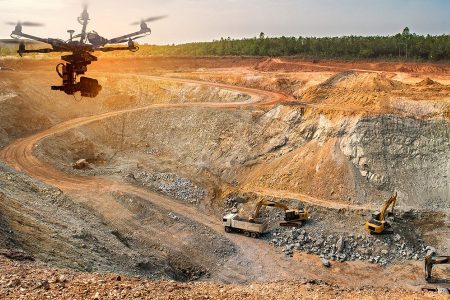
About Us
Aeromotus is a leading and an emerging Drone Technology Company in the Middle East and Africa region with its head offices in Dubai, United Arab Emirates, primarily focused in offering Drone-as-a- Solution.
Aeromotus plays a vital role in the Industry’s Digital Transformation using Drone Solutions, enabling and supporting Organizations in the Middle East and Africa in embracing Drone
Solutions to digitally transform their current work practices to New Generation techniques as a part of the Industrial Revolution 4.0, in order that these Organizations are able to increase efficiency, productivity, accuracy and most important reduce costs when compared to their traditional and conventional methodologies.
Superior Service
A group of knowledgeable and qualified industry professionals are at your disposal to expertly guide you through anytime, making sure our service levels offered remain top notch.
Business Integration
We assist enterprise and businesses integrate drone technology into their use cases, by advocating the right solution and imparting knowledge to get them on speed in using the technology in their day-to-day business, clustered with after sales support and service.
Huge Experience
Experience in business and knowledge sharing with our customers is key to the success of our business. Learning is a continual process and everyday we continue to gain more experience overcoming new challenges.
Quality Products
High precise site-proof products combined with the support of the qualified personnel add to the quality of product in totality in the way it is offered to the market navigating towards business excellence. The main priority for business excellence is to fulfil customer needs and expectations.
Industries
Energy
Oil and Gas
Construction
Survey
Search/ Rescue
Agriculture
Aeromotus functions with the quest to provide comprehensive solutions with service excellence in every industry. With its partnerships with many Drone manufacturers, places Aeromotus as your best supply partner in your journey of digital transformation by Drone Solutions for all your business and enterprise applications.
Contact us
Contact us and Unlock your business potential with us for Drone Technology by obtaining Drone End to End Solutions, Industry Leading Training, Consultancy Services, Drone Services, Aerial Surveying & Mapping Projects.
- +9 715 270446-52
- @Enterprisedronesolution
- [email protected]
- Our working hours 09.00 to 18.00
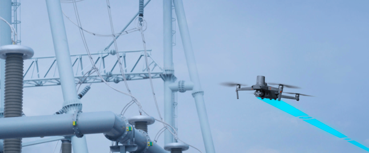
ENTERPRISE DRONES
Enterprise Drones for Surveying, Mapping, Visual and Thermal Inspections, Surveillance, Gas Detection, Public Safety and much more applications...
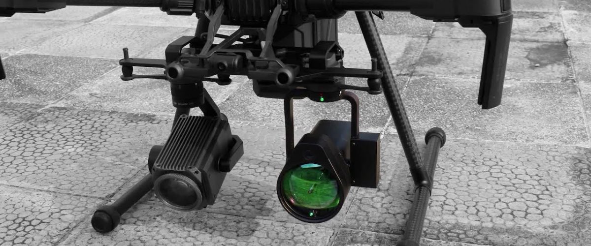
PAYLOADS, CAMERAS, SENSORS
Aerial Photogrammetry Cameras, Surveying Cameras, Oblique Surveying Cameras, LiDAR, Gas Detectors, Multispectral Camera, UV/ Corona Camera and much more..
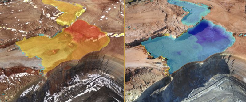
SOFTWARE - PREMISE AND CLOUD
Aerial Photogrammetry, LiDAR Processing, Drone-to-CAD/ GIS, Remote Visual Inspection, Thermal Inspection, Solar PV Analytics, AIpowered Analytics, Hydrographic Processing, Flight Mission Software, Drone Fleet Management Drone Operations...
We Offer

TRAININGS AND SUPPORT
The training was developed for corporations who plan to build up a pilot team and individuals that can achieve the best possibilities for drone applications. This includes an overview of latest UAS solutions, flight operation, mission workflow, flight safety knowledge, maintenance operations, software workflow
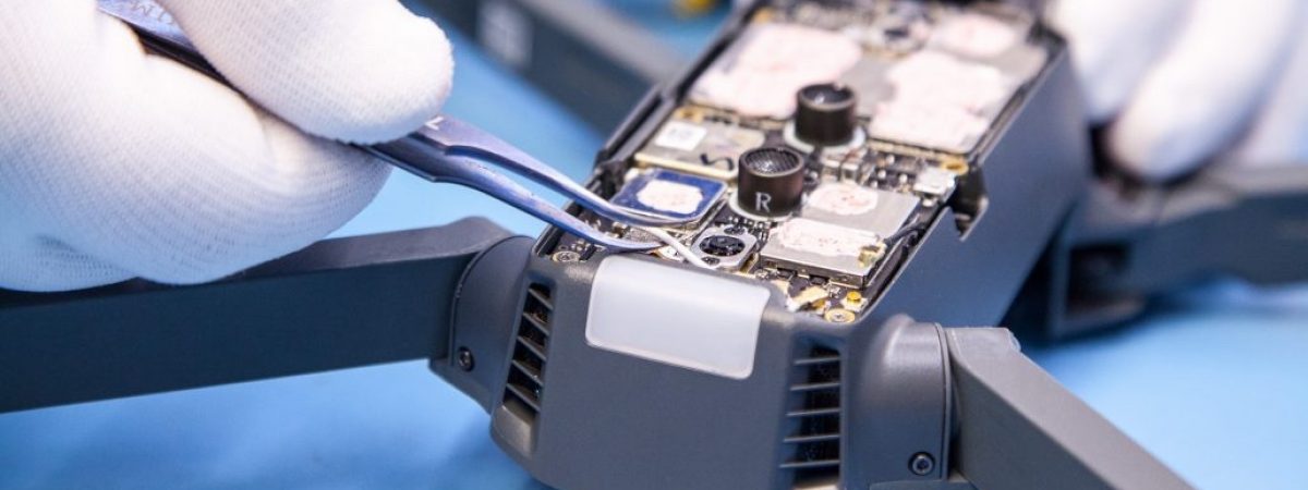
REPAIR SERVICE
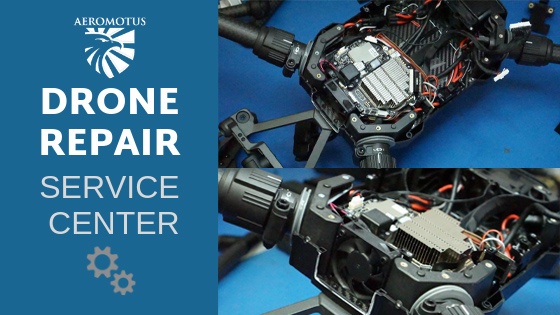
Our technicians are certified, meaning that they know everything there is to know regarding drone repair. As long as the nature of the damage to your drone is possible to repair, we at aeromotus.com will happily fix your drone.
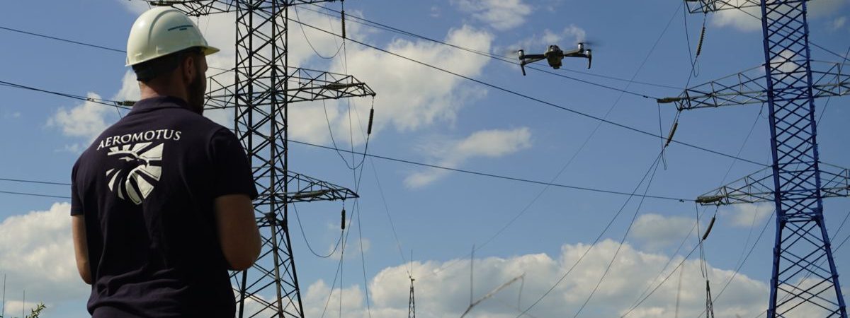
OUTDOOR AND INDOOR DRONE DEMONSTRATIONS
At Aeromotus, we believe every successful product to sell demands demonstration in the right manner to increase customer self-confidence, thus we offer flexible and on-demand drone field demonstrations at pre-approved site locations within the United Arab Emirates and virtual demonstrations for software on data processing and modeling software. We create an experience for you through our demonstrations.
DRONES FOR SURVEYING, CONSTRUCTION, ARCHITECTURE
Topo Surveying, Planning, Design, Progress Monitoring, Volumetric Analysis.
Aerial Photogrammetry Technology
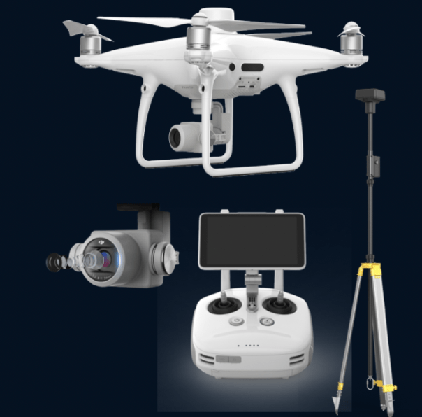
Enterprise-Level Drone Mapping Solution 1cm+1ppm RTK Horizontal Accuracy
1.5cm+1ppm RTK Vertical Accuracy
Photogrammetry & Waypoint Flight Modes
Up to 30 Minutes Flying Time
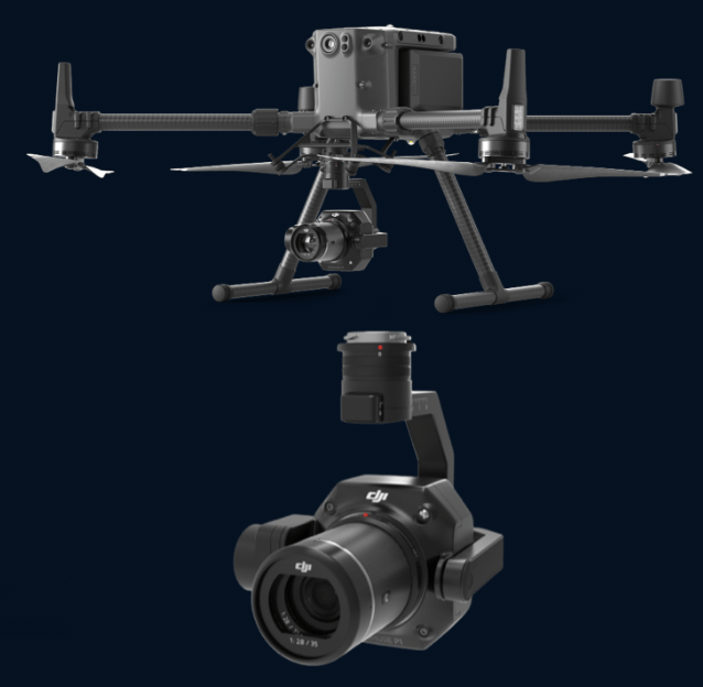
Accuracy without GCPs – 3 cm horizontally / 5 cm vertically
High Efficiency – 3 km2 covered in a single flight
45 MP Full-frame Sensor
3-axis Stabilized Gimbal – Smart Oblique Capture
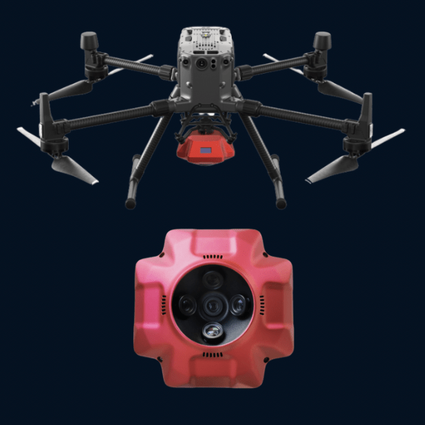
PSDK 102S five-lens aerial oblique camera, designed by SHARE UAV, is a new generation mapping camera can realize drone surveying and mapping with no GCPs used.
DRONES FOR INSPECTIONS AND ANALYTICS
Visual Inspections, Thermal Inspections, Facade Inspections, Solar PV Inspections. Air Quality, Pollution Detection, Ship Emissions Monitoring, Leak Detection, Hazmat Response
Thermal Inspections
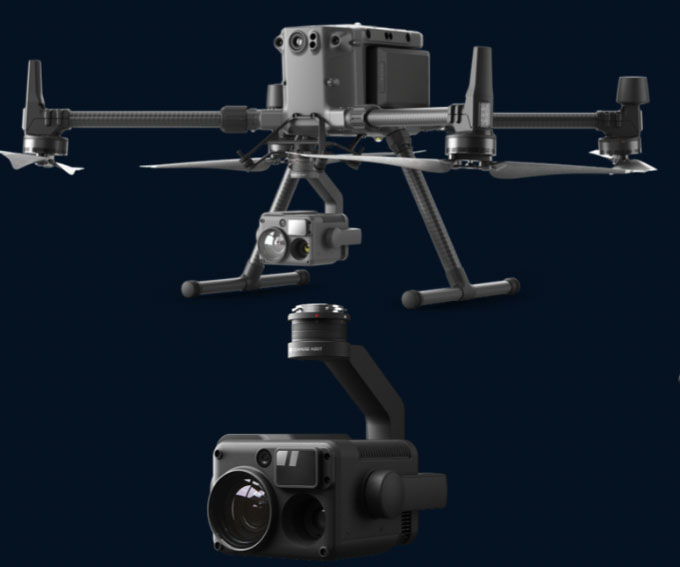
IP44 Rating
-20°C to 50°C Operating Temperature
Night Scene Mode
12 MP Wide Camera
82.9° DFOV
20 MP Zoom Camera
23× Hybrid Optical Zoom
640×512 px Radiometric Thermal Camera
Air Quality and Pollution Detection
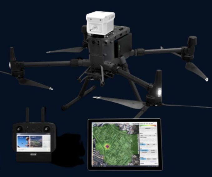
Multi-gas detection system which consists of a drone-mounted gas detection device and powerful analytic software. Sniffer4D is able to measure and visualize real-time gas concentration distribution, providing timely & actionable information for industries such as environmental protection, inspection and emergency response
Multispectral Analysis
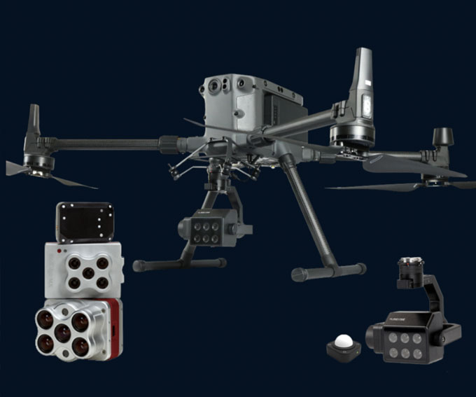
Multispectral imaging camera sensors on agricultural drones allow the farmer to manage crops, soil, fertilizing and irrigation more effectively.
Drone Solutions
Our Digital Transformation Solutions comprises of vast fleet of most advanced Commercial Drone Solutions- comprising of Drones, Payloads, Drone Mapping Software, Image Processing and Modeling Software, Inspection Analysis Platforms bundled with RPAS Training and Software Trainings to empower clients to adapt Drones to their industry need and applications. Drone solutions are complete with providing and Data Analytics Services, Warranty Support, After Sales Support & Maintenance, Drone Accessories and Bespoke Solutions.
Our array of Drone Solutions targets all key market segments like Architecture, Engineering, Construction, Oil & Gas, Energy, Power & Water, Utilities, Surveying & Mapping, Inspections, Public Safety, Agriculture, Mining & Quarries. Our Customers spread across Middle East and Africa, and we extend all of them with the access to the benefits of drone technology by providing solutions that are scalable, faster, and safer.
OUR CONTACTS
- + 9 715 270446-52
- @Enterprisedronesolution
- [email protected]
- Our working hours 09.00 to 18.00
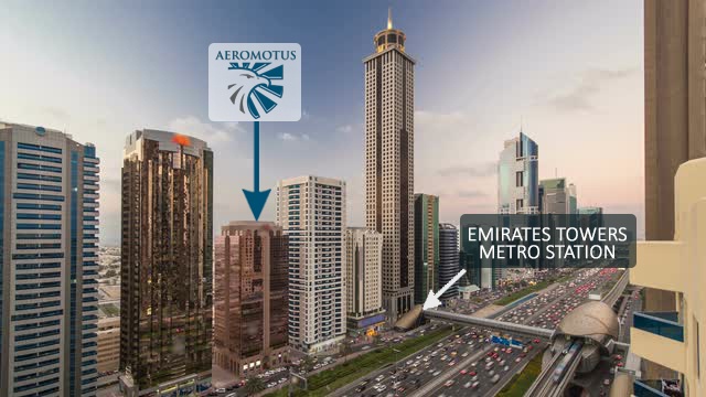
Being based in Dubai and in the United Arab Emirates, the most desired Commercial Capital of the Middle East Region renders Aeromotus in a strategic and commercial position to adopt and serve Organizations and Companies in around United Arab Emirates, Middle East and Africa region.
Contact form Email us with any questions or inquiries or use our contact data. We would be happy to answer your questions.
Contact us and Unlock your business potential with us for Drone Technology by obtaining Drone End to End Solutions, Industry Leading Training, Consultancy Services, Drone Services, Aerial Surveying & Mapping Projects.


