PSDK 102S five-lens aerial oblique camera, designed by SHARE UAV, is a new generation mapping camera can realize drone surveying and mapping with no GCPs used. Camera is seamless docking with DJI Matrice 300 RTK through SkyPort. Using CNC designed housing makes PSDK 102S have better heat dissipation, smaller wind resistance coefficient, stronger structure, which is more conducive to aerial survey flight. Besides, PSDK 102S also has intelligent self-test, one-key reset, intelligent heat dissipation, real-time image transmission and other functions.
PSDK 102S five-lens aerial oblique camera, designed by SHARE UAV, is a new generation mapping camera can realize drone surveying and mapping with no GCPs used. Camera is seamless docking with DJI Matrice 300 RTK through SkyPort. Using CNC designed housing makes PSDK 102S have better heat dissipation, smaller wind resistance coefficient, stronger structure, which is more conducive to aerial survey flight. Besides, PSDK 102S also has intelligent self-test, one-key reset, intelligent heat dissipation, real-time image transmission and other functions.
FEATURES
– Lightweight Camera Body
The volume is only 140 x 140 x 80 mm and the weight is as light as 650 g, which effectively reduces the flight weight and improves the flying duration and operation efficiency.
– Independent POS Data
The five lenses independently collect POS data, and the POS data is accurate to 1 cm. It is compatible with DJI Terra, which can achieve survey with no GCPs used, greatly improve data accuracy, and the efficiency of internal and external operations.
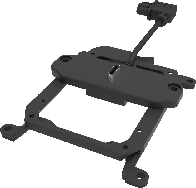
– Easy Mounting
PSDK 102S is mounted to DJI Matrice 300 RTK through SkyPort which is integrated with power, RTK signal connection, data transmission, image transmission.
– Simple Operation
PSDK 102S can be easily controlled on DJI Pilot directly.
Applications
Cadastral Surveying: PSDK 102S can realize surevey with no GCPs used, and its independent POS data accurate to 1cm can meet the cadastral surveying and mapping requirements for accuracy. Topographic Measurement: PSDK 102S has clear imaging and true color reproduction which can provide accurate topographic measurement data and apply it to the ground qualitative exploration, mineral development and river survey and other scenarios. Planning and Design: In the planning and design of infrastructure construction in smart cities, beautiful rural construction, architecture, water conservancy, transportation, etc., PSDK 102S can provide accurate measurement and mapping data, and generate high-quality 3D models as basic data for later applications.
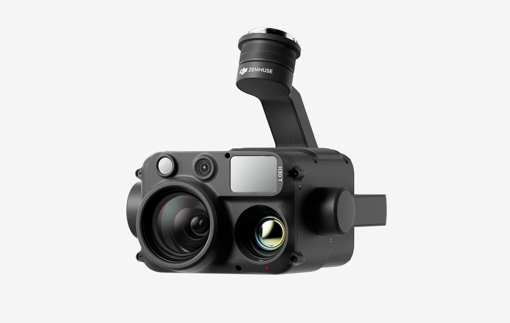
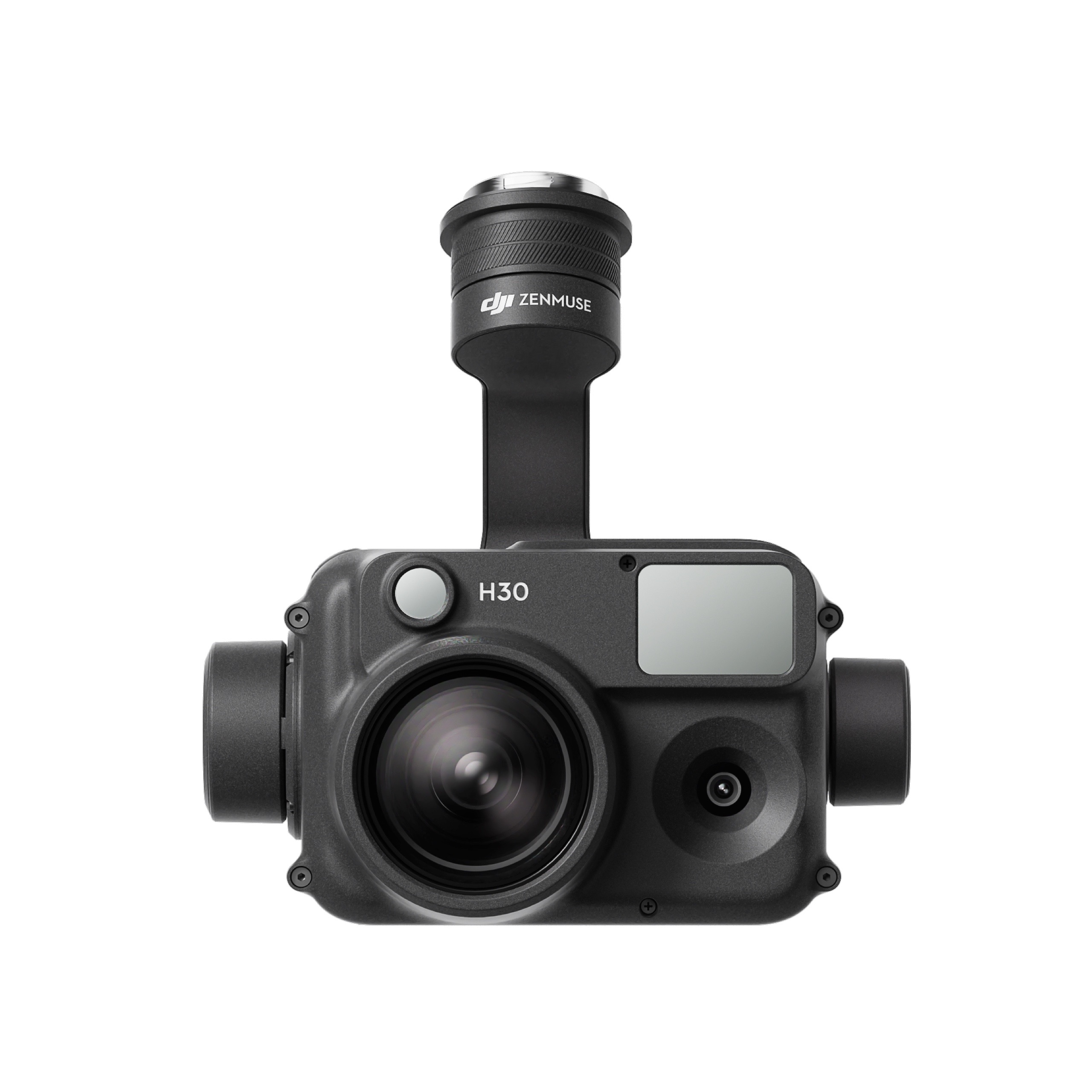
The all-weather, multi-sensor flagship Zenmuse H30 Series integrates five major modules—a wide-angle camera, a zoom camera, an infrared thermal camera, a laser range finder, and an NIR auxiliary light. Employing cutting-edge intelligent algorithms, it revolutionizes perception and imaging standards, transcending the limitations of day and night vision. This makes it effortlessly suitable for a variety of operations, including public safety, energy inspection, water conservation, and forestry.
The all-weather, multi-sensor flagship Zenmuse H30 Series integrates five major modules—a wide-angle camera, a zoom camera, an infrared thermal camera, a laser range finder, and an NIR auxiliary light. Employing cutting-edge intelligent algorithms, it revolutionizes perception and imaging standards, transcending the limitations of day and night vision. This makes it effortlessly suitable for a variety of operations, including public safety, energy inspection, water conservation, and forestry.
This website uses cookies so that we can provide you with the best user experience possible. Cookie information is stored in your browser and performs functions such as recognising you when you return to our website and helping our team to understand which sections of the website you find most interesting and useful.
Strictly Necessary Cookies
Strictly Necessary Cookie should be enabled at all times so that we can save your preferences for cookie settings.
If you disable this cookie, we will not be able to save your preferences. This means that every time you visit this website you will need to enable or disable cookies again.
3rd Party Cookies
This website uses Google Analytics to collect anonymous information such as the number of visitors to the site, and the most popular pages.
Keeping this cookie enabled helps us to improve our website.
Please enable Strictly Necessary Cookies first so that we can save your preferences!
Additional Cookies
This website uses the following additional cookies:
(List the cookies that you are using on the website here.)
Please enable Strictly Necessary Cookies first so that we can save your preferences!