Drone Photogrammetry or Classical Terrestrial Surveying Techniques?
Many scientific investigations were made to prove that drones can easily, quickly, and accurately complete mapping missions and compete with conventional terrestrial mapping methods. Let’s take a closer look at this issue.
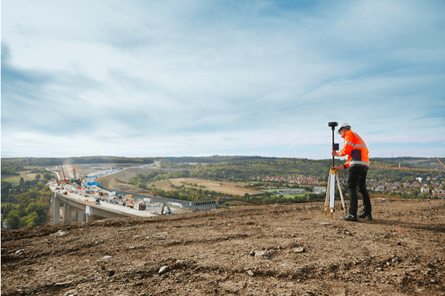
It goes without saying that terrestrial surveying is quite complicated and challenging. Customarily, such professionals used to rely on GPS receivers, total stations, or ground laser scanners to get high-resolution data on land surface photography. Overall, it was an interesting but complex operation. However, unmanned aerial technologies change the situation for the better. Thanks to the continual advancements and rapid development of this area over the past five years, drones became a must-have mapping tool.
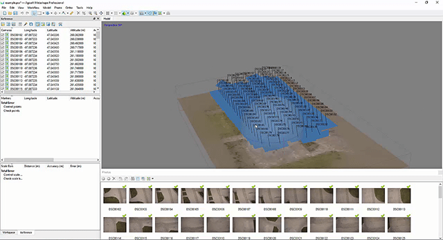
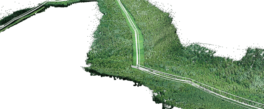
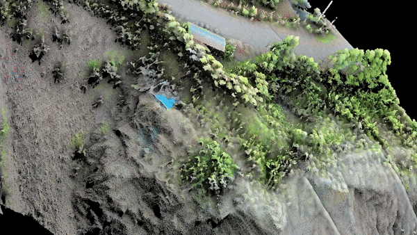
The photogrammetry technique allows experts in this area to create accurate 3D models from 2D imagery. Simply put, photogrammetric techniques combine and process geo-referenced aerial data. Due to this, they are widely used for generating orthomosaics, 3D point clouds, and raster digital elevation models.
Photogrammetric mapping enables land surveyors to do more tasks in less time. It is clear that some surveying tasks may take weeks to complete, but they can be finished within a few days with the help of drones. Therefore, using drones is cheaper and more effective as compared to other methods.
A drone can be deployed within a few seconds above absolutely any site. On top of that, the use of drone technologies eliminates the necessity to send surveying crew into dangerous areas like roadways, rooftops, or unstable soil. Surveying experts can also easily access treetops and towers that seem to be inaccessible.
Is Drone Mapping Accurate?
As we can see, drone surveying has a myriad of benefits but the question is – can drones guarantee the highest accuracy? Definitely yes. Today, drone mapping can replace terrestrial surveying methods. And these aren’t just fluent phrases. To prove this fact, scientists made a few thorough research studies. They investigated a 4-acre church site seven times with the help of DJI Inspire 2. They equipped this drone with a high-precision PPK GNSS system and a Zenmuse X4S camera. The site contained both smooth surfaces and walls with overhead wires. Experts also used data from stereo image pairs to fill in distorted options.
As a result, aerial data collection was finished in half a day. Data processing work took three days to complete this mission.
Overall, drone mapping is sufficiently accurate and can be used for many terrestrial surveying missions. Experts also found that the accuracy can be improved when a drone flies at a lower altitude. We can see that the use of drones resulted in 33% time savings and 58% cost savings.
There’s another successful example of drone surveying where a team needed to collect aerial data from a 260-acre golf course in one day. Let’s take a closer look at this example. If surveyors use a classical method, the whole operation will take 30 days to collect data. But when a drone is used, this site can be mapped in 15 days and save 75% of costs and 50 % of savings.
However, researchers didn’t stop there and decided to do another inspection. They wanted to check the economic viability of drone mapping. To achieve that goal, they decided to do a rooftop survey of a solar panel. The drone mapping team investigated three grocery store rooftops. The size of these rooftops varied between 3 acres and 7 acres. As a result, they managed to do thorough research without putting any worker on the rooftop. They investigated panels, roof vents, skylights, gas lines, and HVAC units. Mind that a traditional terrestrial surveying method usually takes 12 days whereas a drone mission (including data procession) takes seven days, resulting in 41% cost savings and 59 % time savings.
Overall, drones can be used for a wide array of purposes today and land surveying is one of them. Gradually, drones will undoubtedly replace traditional terrestrial surveying methods. For example, the next-generation drone, the DJI Phantom 4RTK, allows experts in this niche to get centimeter-level data accuracy, but it doesn’t require many control points. The DJI Terra, one of the best mapping software allows surveying professionals to get the desired output quality for their projects.