Aerial Geological Survey of Hazardous Processes
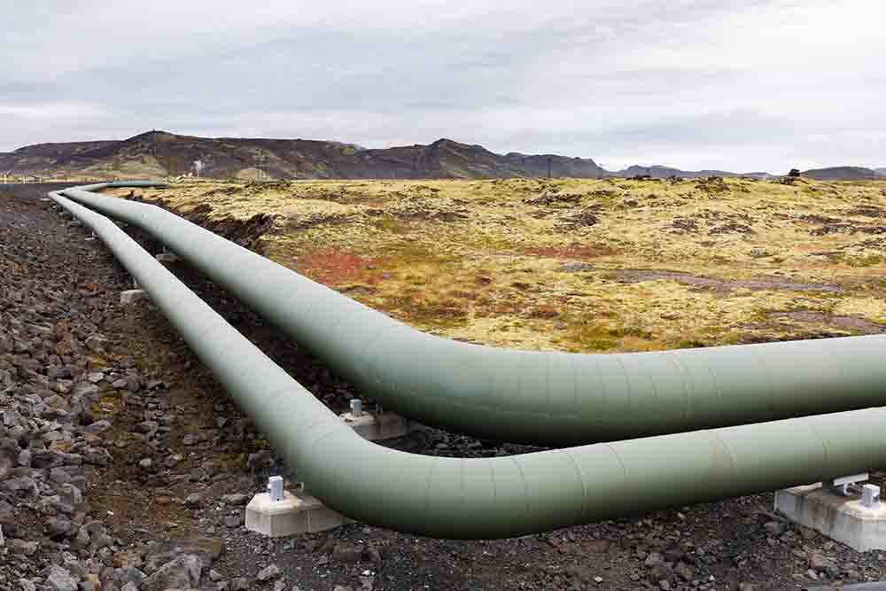
One of the world’s largest gas producers, the Middle East accounts for 38.4% of global gas production. In addition to the resource base and its timely reproduction through the development of (primarily active) reserves, the presence of a gas transportation system is also crucial for developing and successfully functioning the gas complex. Industrial facilities in this system pose a high risk, and gas transportation may cause significant environmental damage, mainly where permafrost exists.
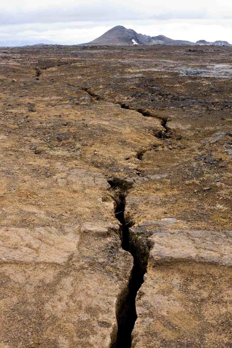
The construction of pipelines transforms landscapes and ecosystems. Transport lines often run through challenging geological conditions, and it is impossible to omit negative natural factors from their design and construction.
An operation of a pipeline also requires information about changes in previously identified construction zones. Observing the geological environment conditions periodically and acquiring its quantitative characteristics serves this purpose. Over time, tracking factors trigger the activation or occurrence of geological processes and phenomena that harm technical structures.
Monitoring systematically observes any object and/or its environment over time to acquire its quantitative characteristics. The age-old conflict between surveyors and those who build and operate technical facilities should have been resolved with many available monitoring methods. However, in trade and economic relations, all parties seek to maximize profit at the lowest possible cost. In many cases, well-established monitoring technologies are prohibitively expensive.
Airborne Laser Scanner Monitoring
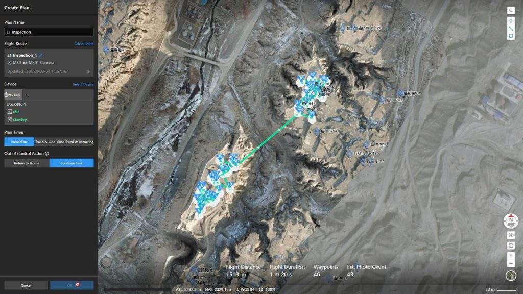
As a rule, linear object monitoring requires several laser surveys with different degrees of accuracy, depending on the tasks set by the customer.
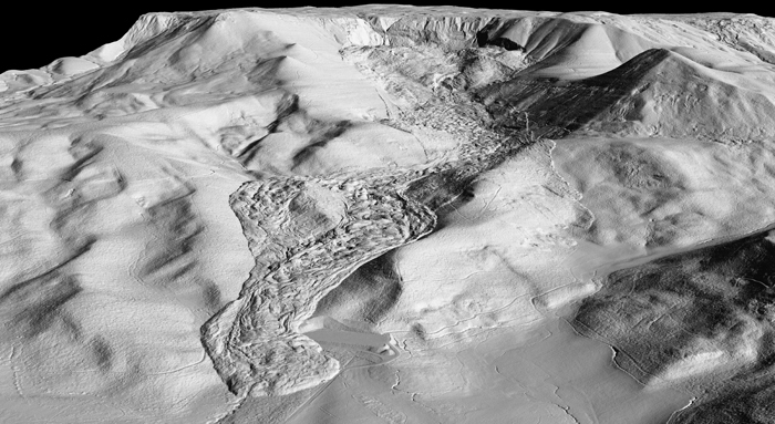
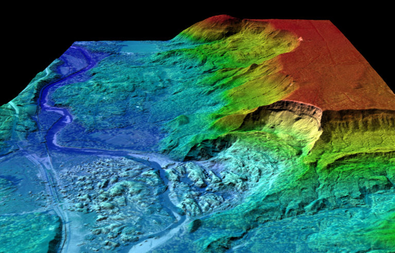
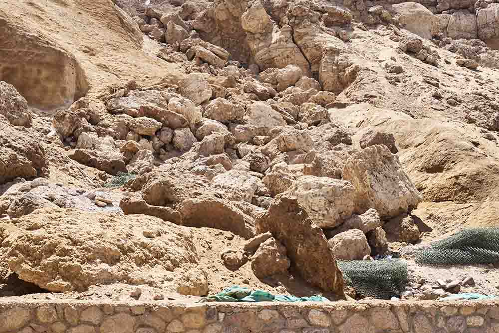
As landslides form distinctive forms in the meso- and microrelief, they can easily be recognized in medium and sometimes small-scale 3D models because of the advanced interpretation of synthesized 3D models. A landslide zone in the projected pipeline corridor is distinguished by its key decoded features, distinguishing it from the rest of the slope. Its heterogeneity distinguishes it from the rest of the slope. By analyzing the shape of the landslide body and the landslide cirque, geo-engineering classifications can be used to determine the type of landslide.
A monitoring setup project is developed to monitor the following landslide structures: landslide body contours, landslide mounds and depressions, cliff characteristics, displacement amplitude, and so on.
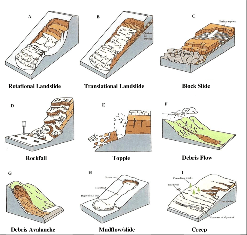
It is essential to conduct monitoring after geological surveys. Otherwise, the data obtained cannot be used for forecasting. Landslides are often caused by imbalances in the geo-ecological environment, so a comprehensive understanding of the geological and hydrogeological conditions on the slopes where they occur, the genetic types of landslides, and the factors that facilitate their development are necessary.
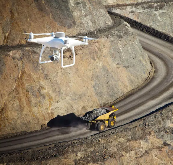
Aerial laser scanning can monitor relief and ground objects to collect geospatial data. In this case, measurements are essential, as in classical geodetic work. As a result of regular observations, airborne laser scanning provides much more accurate information about relief changes than traditional geodetic measurements.
Advantages of Airborne Laser Scanning:
- Short technological chain;
- Guaranteed specific measurement accuracy, depending on the flight altitude above object;
- no need for ground geodetic works during a compilation survey due to the use of direct geopositioning;
- High productivity due to the transfer of ready topographic data for cameral processing.
“Combining LiDAR with GIS improves both the quality and the accuracy of geological data and enables geologists and disaster preparedness experts to identify landslide prone areas and study the underlying causes of a landslide and recurring patterns.
High-resolution LiDAR modeling reveals subtle surface features that are simply undetectable via aerial photographs or field observation. This helps with mitigation planning, landscape modeling and thus saving the lives of millions of people as well as the infrastructure.
LiDAR also increases the efficiency of observation multiple times. In 2009, a study of how many landslides had been mapped before the state of Oregthe on in US started using LiDAR found around 10,000 mapped landslides. Using LiDAR, there was more than a fourfold increase of landslides in that same database, and it covered only a small area of the state.” How LiDAR helps in preventing and mitigating landslides By Aditya Chaturvedi
The informative value of the airborne laser scanning method
Processing a point cloud to acquire initial data (predictive maps of hazardous geological processes) not only improves engineering survey quality, but also helps identify the areas where periodic observation equipment should be installed early.
As a result of exogenous analysis, it is possible to determine what characteristics characterize the spatial distribution of dangerous geological processes. Specifically, it is possible to detect groupings of exogenous relief forms due to unavoidable natural factors.
After decoding, the acquired data become auxiliary material for geo-engineering surveys, allowing us to understand the processes prevalent in the area, the types of soil it may contain, and the location of the soil. In many cases, all that remains is to confirm the presence of a remotely identified dangerous geological process, which allows not only to save time at the geo-engineering survey stage but also to minimize information loss (which can occur during the ground survey, when the specialist on the ground may overlook the ongoing process).
In the digital elevation model (DEM) and on the ground, the edges of landslide breaks are quite well defined.
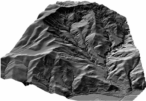
During a standard geo-engineering survey and photographic documentation of the area in question, identifying hazardous geological processes along extended objects takes significant time, especially under difficult mountainous conditions. Using a 3D model generally simplifies the solution of this task during monitoring, focusing only on selected areas.
Geoengineering maps are developed using data from image interpretation, field engineering, and geological surveys. After identifying the materials, landslide segments and younger landslides formed on older landslides are identified in the designated future monitoring zones.
Landslide Monitoring
Landslide monitoring does not only entail the acquisition of quantitative data. A causal relationship with the predicted development of dangerous geological processes must also be established.
A static geological model is required for an adequate interpretation of the monitoring data, as well as its comparison with the resulting dynamic measurement model and a calculation of possible variations in the geological environment due to the factors identified at the area study stage (building a static model) and at the monitoring stage (building a dynamic model).
Ideally, in addition to the two above-mentioned models, the use of archival materials in the geological study of an area will allow the building of an equally significant historical model. All three of the above models will ensure maximum reliability in choosing a hypothesis on the progress of the ongoing geological process.
An assessment is conducted of the static model obtained as well as the historical model (with archival materials available), followed by the development of monitoring schemes concerning interpretation results, which are accompanied by the determination of sufficient observation methods.
Data reliability during monitoring can be improved by incorporating dynamic and static surface models, representing the deformation benchmarks’ displacement dynamics. Information obtained from a dynamic model is not a new concept – only the equipment and information chains have changed.
Let us consider data acquisition and its comparison with the results of traditional geodetic observations.
An analysis of the dynamic model’s spatial data demonstrates that relief changes are not visible at all geodetic profile points. They are used to identify separate sections where changes occur. These profiles are built based on the laser scans of the studied areas obtained at different times. Changes along the alignment are recorded during the automatic matching of the multi-temporal models.
The profile highlighted relief change zones are clearly visible in the synthesized residue model. This procedure allows both to visually assess the geodynamics and to build temporal change isolines, subsequently superimposing the result on the relief model.
Measurements reveal quantitative characteristics in both airborne laser scanning and conventional geodetic surveys. However, using the ‘classic’ geodetic method is sufficiently informative only if the setup is correct. When both types of measurements are used together, identical changes in relief are revealed. Accordingly, the dynamic model constructed proves to be more informative in this situation.
Preliminary short-term forecast based on the obtained results
The activity of landslides may differ, or they may not be at all active. In some cases, tectonic processes and technological influences are the only prerequisites for forming landslides on slopes. Laser scanning results (consistent with dynamic and historical models) and geodetic observations reveal recent changes in landslide structures.
As a result of the interpretation of data across all the above models, monitoring quality and information content have improved. Shifts in the blind zone previously undetected by the deformation benchmarks installed higher up the slope have become more apparent.
Conclusion
Geodesic monitoring is more accurate than airborne laser scanning. When mountainous conditions are challenging, linear objects have an extended span, placing deformation benchmarks in the selected clusters is impossible, or when budgets are limited, airborne scanning is quite informative and allows for constructing static and dynamic models.
Geophysics, geology, and hydrogeology data and monitoring results can be evaluated more accurately using 3D terrain models that account for harmful factors’ relief and potential effects on construction.
CONTACT US
-
Our office is located in one minute walk from the Emirates Towers Metro Station
1502, Al Moosa Tower 1, Sheikh Zayed Road, Dubai, UAE
-
Telephone: +97143512929
- E-mail: [email protected]
- WhatsApp: +971 56 218 8408

Resources
- “Engineering research and design: a single complex of experts ” Baborykin Maxim – 2015.
- MONITORING OF HAZARDOUS GEOLOGICAL PROCESSES IN THE CONSTRUCTION AND OPERATION OF PIPELINE TRANSPORT FACILITIES BY REMOTE SENSING DATA
- How LiDAR helps in preventing and mitigating landslides
- Oso Landslide Lidar
- Relationships Between Slope Instabilities, Active Tectonics and Drainage Systems: The Dúdar Landslide Case (Granada, Southern Spain)