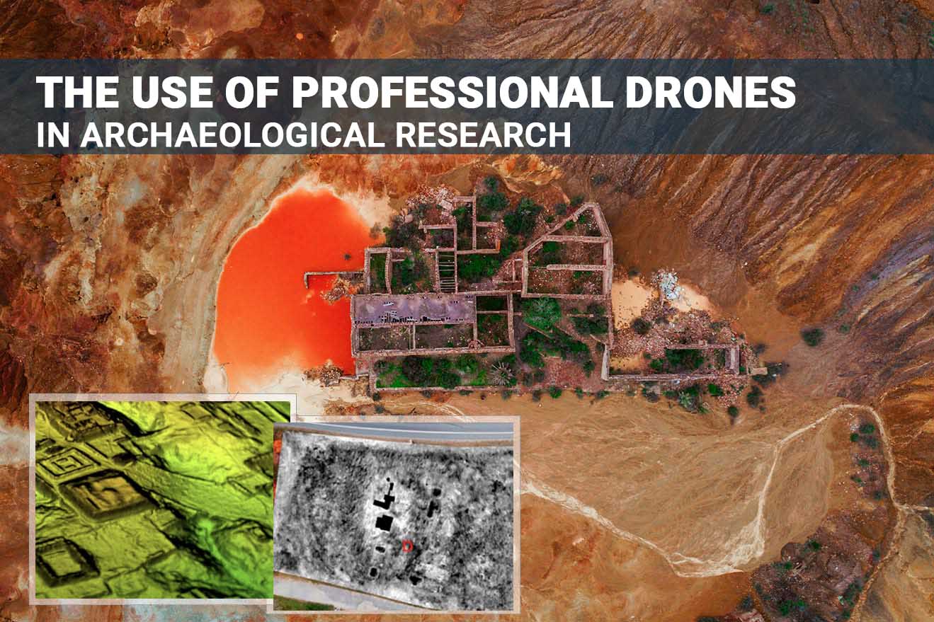
Technology to create digital copies of buildings, structures, entire compounds and industrial areas has existed since the 1970s, but only recently have they become accessible, convenient and widespread. This happened
Case Study: DJI M600 Pro with Echosounder for Bathymetric Survey
Project Location United Arab Emirates Customer GeoDrones Aerial Services, Dubai Prepared by Sanju Mathew, Aeromotus (DJI Enterprise) Dubai Drones for Survey & Measurement DJI Industrial Drone M600Pro with the Echosounder,
Drone Photogrammetry or Classical Terrestrial Surveying Techniques?
Many scientific investigations were made to prove that drones can easily, quickly, and accurately complete mapping missions and compete with conventional terrestrial mapping methods. Let’s take a closer look at
Matrice 300 RTK as the Main Inspector’s Tool
Thanks to smart AI features, M300 RTK makes drone inspections more efficient. It goes without saying that drone inspections are an integral part of any industry. Whether you need to
DJI Terra – the Best Tool for Processing Drone Data
Having a powerful flying machine is not enough. You should also have reliable drone mapping software that allows you to process and visualize aerial data. This is where you simply
Autel Evo II: Overview of the Main Commercial Applications
Evo II – a tool that always works hard as you do. This drone was designed with portability in mind. Absolutely each component goes through multiple tests before it leaves
Overview of the Main Advantages of IoT for Modern Farming Industry
It goes without saying that smart farming, with the help of IoT technologies, offers numerous benefits for farmers. But the first and foremost advantage is increased productivity of experts working
Understanding the Benefits of Gas Detectors
Modern technology is continually evolving; we see that new and much better units appear on an ongoing basis. Therefore, it is no surprise to see that the drone industry also
DJI 4 Multispectral – the Best Tool to Speed up Assessments of Crops
A well-known French insurance company, Groupama, started using the DJI P4 Multispectral a few months ago. The main goal of this decision is to provide its farmer-clients with accurate multispectral
Overview of the Best Laser Scanners for Drones
Overview of the Best Laser Scanners for Drones It goes without saying that laser scanning is the most effective technology allowing experts from different areas to get high-quality three-dimensional models