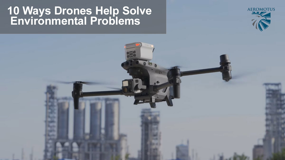
10 Ways Drones Help Solve Environmental Problems
Drones have revolutionized how researchers and scientists gather environmental data worldwide. Drones are driving a greener future through conservation initiatives and improving renewable energy production. In this article, you will learn:
- How drones help control plant cultivation and land reclamation
- What makes drones indispensable in wildlife preservation
- In which ways drones help make energy production safer and efficient
An increased body temperature by just 2°C causes us to feel a slight fever. The same applies to the ecosystem. The excessive emissions of greenhouse gases caused by humans since industrialization have led to a warming of the earth’s atmosphere’s lower layers. As a result, we are facing extreme weather fluctuations with periods of drought, rising sea levels, and losing biodiversity.
In light of this background, we must take climate change seriously. By switching to renewable energies, expanding electromobility, and using drone technologies, environmental protection could be promoted over the long term. Let’s explore how drone technologies help save the planet.
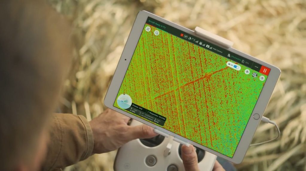
1. Targeted action in plant cultivation
DJI Phantom 4 Multispectral is a popular agricultural drone for various environmental monitoring purposes, and it has won stable market popularity for a good reason. P4 Multispectral provides a quick overview of plant health in the selected area. The resolution spectrum ranges from individual plants to entire fields, so DJI agricultural drones can monitor soil conditions and weeds.
This preciseness saves enormous human and time resources. Previously, experts had to inspect the plant growth or pest infestation directly – an effort that could be massively reduced in the future. All in all, the DJI Phantom P4 Multispectral should improve crop yields and reduce costs. For more information, get in touch with the DJI’s authorized dealer and see what’s new in developing camera drones for aerial photography.
According to marketing research, sales of agricultural drones should increase massively. The agricultural drones alone are predicted to generate sales of almost 5 billion dollars by 2024.
GPS-controlled drones can help to transmit an exact picture of the condition of crops and soil – several hectares of land can be flown over in just a few minutes. The information obtained can then be used to determine, among other things, whether more water or fertilizer is needed, and the degree of maturity can also be determined in this way.
After the drone has flown over, the collected data is calculated on digital maps, which in turn serve as a basis for calculating the exact amount of fertilizer, water, and pesticides required. In this way, excessive resource consumption can be counteracted, and the soil pollution caused by the application of plant products is also reduced.
2. Restoring vegetation at oil & gas sites
Mining, quarrying, and oil and gas extraction industry is investing a lot of effort in natural resource exploration and subsequent land reclamation after the oil extraction has been finished. Drones play a critical role in resolving this issue by collecting data and monitoring vegetation growth more efficiently. The aerial data captured with the help of the latest drone technology helps monitor and measure the reclamation process in the state of Colorado, USA. State regulators can instantly see the state of recovery of agricultural fields without the need for individual site visits.
The use of water sampling equipment on a drone helps to take samples of water and other liquids in a variety of use cases, such as sea water with oil spills or bacterial research of lakes.
3.Examining solar panels, turbines, and gas pipes
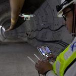
Thermal data helps identify leaks and other issues along the pipeline. Surveyors run drones on Micasense Wingtra One platform turn to multispectral data to help identify leaks and other issues along the pipeline. DJI Matrice 300 RTK+ H20T is a reliable industrial drone platform that is robust enough to withstand extreme weather conditions and offers up to 55 minutes of fly time without recharging.
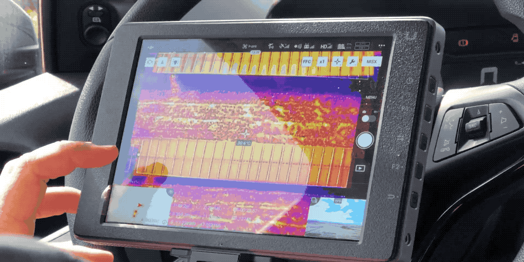
Thermal data collected by drones helps ensure the safety of gas pipelines and green energy installations such as solar panels and wind turbines. Surveyors run drones with sensor and get data to help identify leaks and other issues along the pipeline. With the help of technology such as the Sniffer 4D Multi-Gas Detection & Mapping System, scientists and environmentalists can visualize real-time gas concentration distributions. Sniffer4D provide real-time information that helps first responders, environmental agencies, and researchers in the oil&gas industry to improve work efficiency, mitigate risks, and reduce costs.
Drones make it possible to survey broad sections of large and remote machinery quickly, and they can also survey areas that are hard to reach with traditional, manual tools.
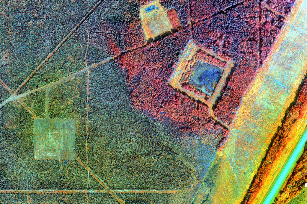
4.Monitoring remote natural reserves
It’s easy to characterize marsh aboveground biomass using remote sensing with drones. However, most satellite and airborne sensors have limited spatial and temporal resolution—imagery from drones closes this data gap. For example, a DJI drone and Micasense Rededge sensor were used on the Carpinteria Salt Marsh Reserve in California, USA, to study the salt marsh plants and create biomass maps for each season.
Bees pollinate all varieties of crops, so if they disappeared, humans would only be able to grow 28 crops. West Nile virus and Lyme disease outbreaks have been attributed to removing some species that act as buffers between humans and pathogens.
European Commission
5.Drones and documentation
When it comes to documentation, drones are indispensable. To combat climate change, it is important to know what you are campaigning for and what the impact of climate change is. For this purpose, data must be recorded in order to be able to analyze them later.
The collection of the data is often very complex and often involves enormous costs. For example, if you want to record a forest fire’s effects, you must fly over the area at regular intervals. Previously, this required an airplane, a pilot, and a photographer to capture the extent of the fire.
With drones, the project can be implemented much more easily and cost-effectively. A pilot can control the drone or even fly over the desired area autonomously based on a flight route. It creates recordings and forwards them to a ground station for analysis.
In addition, you can fly closer to dangerous areas with the drone since you do not endanger human lives but, in the worst case, suffer a small financial loss. If, on the other hand, an airplane crashes, the financial damage is significantly higher, not to mention the dangers to the life of the crew and pilots.
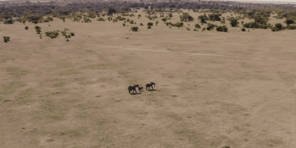
6.Tracking and mapping wildlife
Conservation drones help protect endangered species by tracking wildlife for various conservation and anti-poaching projects. Drone technology has been effectively used by many countries and organizations to view wildlife at hard-to-reach locations. Conservation drones fly at a safe distance to protect endangered wildlife and empower environmentalists to work more safely, accurately, and cost-efficiently.
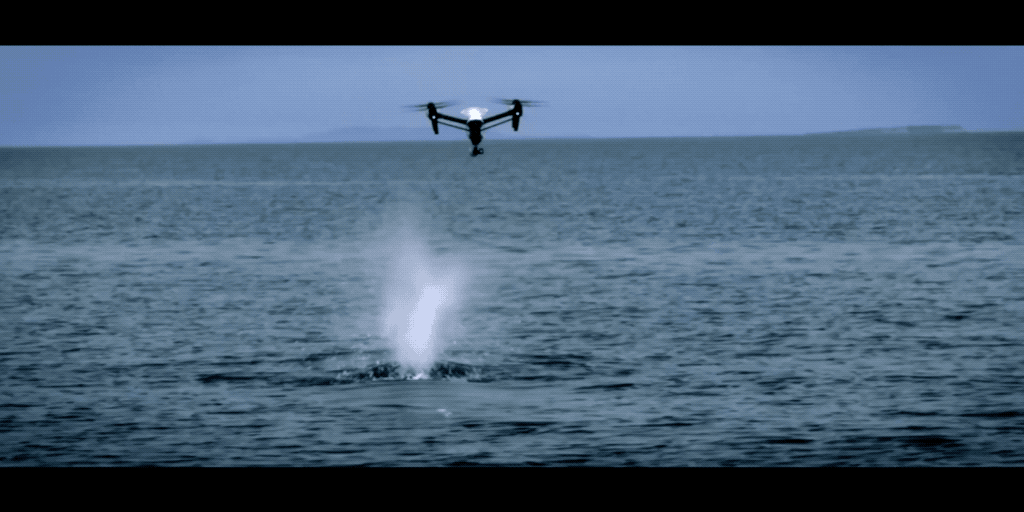
From monitoring Sandhill Cranes in Colorado to counting waterbirds in Florida to surveying orangutan nests in Indonesia to monitoring seals in the Arctic, this technology is used for a wide range of wildlife preservation purposes. For example, water sampling becomes quick and effortless with Speedip, a drone water sampling system that enables scientists to collect water samples from anywhere, even a remote glacier or a volcano lake!
|
Where Humans Cannot Reach: How Drones Help
|
The data collected is invaluable to climate researchers. Using the data, they can create models of future developments and derive measures to combat the risks. In addition, the recordings can be used to sensitize the population to the dramatic effects and to raise awareness of the topic. Statistics are important, but pictures usually have a stronger effect and motivate people to get involved in stopping or at least slowing down climate change.
7.Drones to protect biodiversity
Biodiversity is closely linked to the climate. To counteract the global imbalance, it is essential to know the current status of animal and tree populations. This means that existing resources can be used efficiently in the areas that are acutely affected. Here, too, drones make data collection much easier thanks to the latest technologies leveraged by drone-as-a-service (DaaS) providers such as Aeromotus.
For example, animals can be detected and localized from the air. Numerous universities use the system in teaching and research. For example, the University of Applied Sciences Würzburg-Schweinfurt in Germany identified and localized trees in the Würzburg area as part of a project. But other scenarios, such as recognizing and mapping fawns before harvesting a field, can also be implemented in this way.
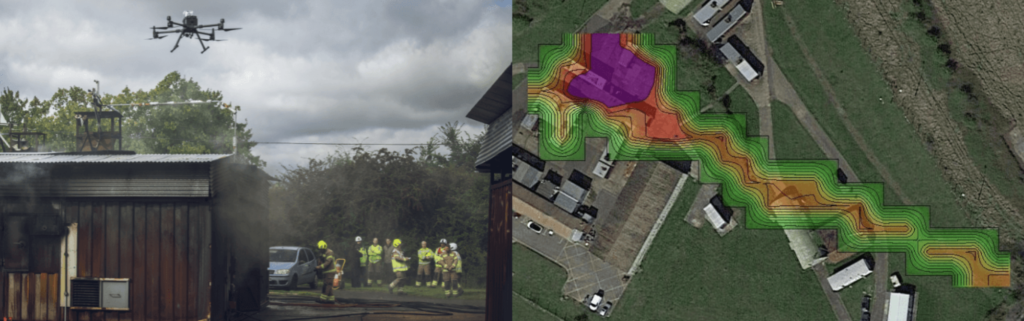
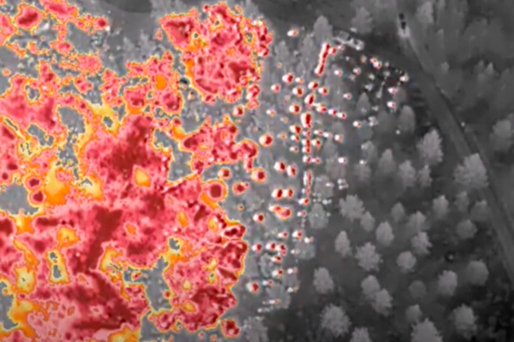
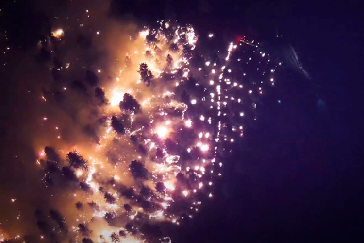
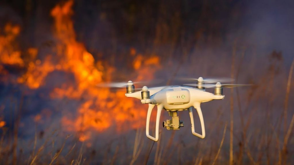
8.Drones in the fight against forest fires
Forest and bush fires are part of a natural cycle of the ecosystem. However, what is of concern here is the extent and increasing frequency of its occurrence. Climate change is leading to extreme weather fluctuations with long periods of drought, which encourage forest and bush fires.
To contain the spread of fires more quickly, early detection is necessary. Drones can help with the early detection of forest fires. Sensors attached to the drone allow larger forest areas to be searched for possible sources of fire more quickly and cheaply.
|
Due to the destruction of rainforests, deforestation accounts for about 15% of global CO2 emissions. Because of their constant growth, the tropics have been able to bind large amounts of CO2 as well as further climate-damaging gases. Currently, this ecosystem is in grave danger. |
In the event of imminent danger, emergency services can be requested more quickly and efficiently. As a pioneer, Australia has already started a pilot project called “Mission Fireshield,” cooperating with the philanthropic Minderoo Foundation and the Australian Minister for Science and Technology. Here, drones should be used for the early detection of forest fires and possibly also for extinguishing such fires.
9.Drones for forest restoration
Speaking of forests, drones also offer the possibility of faster and cheaper reforestation. In addition to faster and more efficient data collection, drones can actually carry seeds. For example, pure pine forests burn faster because these types of trees contain more essential oils and resins. Drones can be used here to spread seeds more quickly over larger areas. After the severe forest and bush fires of 2019-2020 in Australia, special drones are currently used by World Wide Fund For Nature (WWF) to scatter seeds from eucalyptus trees over remote areas to revive the burnt bush landscape.
10.Logistics and parcel delivery
One of the global mega threats to the environment is increasing urbanization. More and more people reside and live in cities, whereas the rural areas are subject to a “rural exodus.” Around 55% of the world’s population currently lives in cities, according to the World Bank, and this poses increasing challenges for city administrations. The infrastructure is overloaded in many places, and air pollution is increasing dramatically.
In addition, more and more people are ordering their goods online instead of buying them from a local retailer. By 2025, it is estimated that 500 million packages will be delivered to cities every day. This leads to enormous air pollution from exhaust gases and thus a burden on the global climate. In London, freight transport is responsible for around 38% of CO2 emissions.
This offers the ideal conditions for the CO2-free delivery of parcels by drones. These can easily pick up the light packages and transport them to their destination. This reduces the traffic load in the city centers and at the same time the drones do not emit any environmentally harmful CO2 when transporting the parcels. This means that climate-friendly logistics can be implemented within the cities.
In logistics, drones have the potential to dramatically change the way goods are transported in terms of CO2 emissions. We assume that the use of drones will steadily increase and that drones as postal and parcel carriers will be the rule rather than the exception in the future.
Final thoughts
The wide range of possible uses of drones to protect the environment is little known in society at large. The advantages of drones compared to other technologies are obvious: Compared to cars, no fossil fuel is required for their use, and the need for infrastructure such as road network is far lower. Instead, drones are often associated with military missions. However, there’s a question of whether the danger is the technology itself or the person using it.
Ready to start getting the most out of drones? Get in touch with Aeromotus, the leading drone technology partner for the Middle East and Africa region.