Ground Control Points | DJI Enterprise
Everything you need to know about GCPs to improve your drone surveying accuracy
When it comes to drone surveying, effective ground control point placement is everything. GCPs help define the boundaries of your site and properly scale everything in between. They are a true building block of any surveying job and improve the accuracy of your map.
To get optimal results out of your ground control points, however, you need to ensure they are placed correctly. With too few total points, you run the risk of inaccurate measurements. However, if too many GCPs are near each other, it could corrupt the overall aerial imagery. Here’s how to strike the right balance — and get the most out of this proven surveying method.
What are ground control points?
Ground control point materials
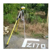
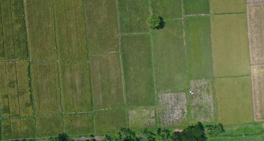
A ground control point must meet two criteria to be useful in aerial surveying. Each point should be made with high contrast colors that stand out from the surrounding terrain — too similar and the GCP will be hard to find in photographs. In addition, points should have a clearly defined center that aligns with the known coordinate. This can be done with two perpendicular lines.
Surveyors will typically either use spray paint or specialty pads with bright colors and a four-squared “checkerboard” look to create the coordinate system. While spray painting may be the more convenient and cheaper option, it also may create accuracy issues. As you know, the difference of a few centimeters can have an outsized impact on a surveying job. The wider surface area of a line of spray paint could mean a multi-centimeter range in the “bullseye” of your mark. While the discrepancy is relatively small, doing this kind of guesswork for each of your points could be disastrous. If you don’t have any pads available, it is best to mark GCPs with an “L” shape, rather than the traditional “X,” with the corner indicating an exact coordinate.
GCPs v. manual tie points
How do ground control points enhance drone surveying?
Whether you need a photogrammetry or LiDAR map, ground control points help deliver as accurate an aerial map as possible. These points are important to surveyors because they are set with absolute accuracy. This means that a point correlates to a true value, such as a GPS coordinate. Relative accuracy, meanwhile, describes other points that can be found by scaling a map against these absolute coordinates. In other words, by having multiple known geographic locations already set in the real world, it’s easier to establish the distance between points and the overall scale of your map.
Of course, ground control points are only a part of the puzzle. Ground sample distance, for example, is a calculation used to explain how the real world scale established by GCPs translates to a map. The GSD describes the distance between the center point of two consecutive pixels on a digital image. Without an accurate GSD, it’s impossible for surveyors to turn all the drone data they collected into usable maps. Just like for ground control points, a GSD calculation that’s off by as little as a few centimeters can have wide-ranging implications throughout an entire project.
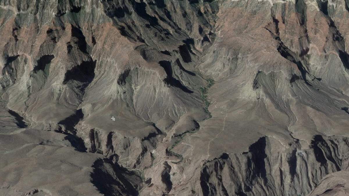
Placing your ground control points
Number of points
The number of points needed to create an accurate drone map varies depending on the size of a site and the range of terrain. Experts typically recommend using at least five GCPs, but as many as 20 or so are sometimes used. It’s important to note, however, that more points do not necessarily mean a better reading. In a trial conducted using the DJI Phantom 4 Pro, the Nevada Department of Transportation found that additional GCPs offered diminishing returns after about 10 points.
As you select ground control points, try to focus on establishing an even placement. While it may seem intuitive to cluster multiple GCPs around the area most important to your survey, doing so may actually reduce accuracy. If too many points are near each other while the rest of the site sees limited coverage, it will be challenging to calibrate the map and understand how the cluster of coordinates fit in the larger picture. In a worst-case scenario, you may need to refly the entire site.
Spacing
Distribution
It’s important to use your ground control points to define the boundaries of your site. In an ideal scenario, you’d be able to place a GCP in each of the corners, with another in the site’s center. While sites are rarely this simple, it’s still a good way to think about coverage.
One final consideration is capturing the full range of topography on your site. At the very least, place a point on both the highest and lowest elevations at which it’s feasible to do so. With that said, it’s important to avoid the pitfall of relying too heavily on “naturally occurring” points that may look like a good place to put a GCP but don’t compliment the overall even spread of points.
The right drone and payloads for accurate surveying
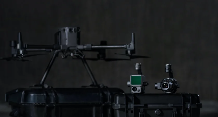
Whether you’re performing aerial photogrammetry or LiDAR mapping, DJI also has the payload you’re looking for. The Zenmuse P1, our flagship photogrammetry payload, comes equipped with a 45-megapixel full-frame low-noise high-sensitivity sensor with interchangeable 24/35/50mm fixed-focus lenses.
For surveying jobs that require LiDAR, meanwhile, we recommend the Zenmuse L1. With high-accuracy IMU and dense foliage penetration at a reasonable price point, this payload is perfect for surveying even the most complex terrain. Both cameras easily integrate with our premier mapping software, DJI Terra.