Pix4Dmapper Essentials + Pix4Dmapper In-depth workshop


Date: February 2-5 2020
Location: Millenium Plaza Hotel Dubai.
Description
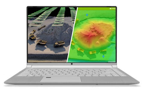
You will learn best practices for capturing RGB images and creating, managing, analyzing, and sharing 2D and 3D representations of reality. A series of hands-on exercises will demonstrate how to work effectively with the Pix4Dmapper solution.
Best practices for planning, flying, organizing, and merging projects will be covered. In addition, we will discuss troubleshooting methods and highlight the Quality Report.
We will also review processing options for point cloud generation and strategies to produce cleaner point clouds, in addition, to clean up “noise” when necessary.
By registering for this workshop you are eligible to receive a 50% discount on the Pix4D Certification exam.
Level
Public: from beginners to experienced users with Pix4Dmapper.
Content: we will cover topics of beginner to advanced levels.
Objectives
- Produce accurate 2D and 3D georeferenced representations of reality, including orthomosaics and 3D models
- Acquire accurate measurements
- Share your deliverables with stakeholders
- Articulate knowledge of large project image acquisition.
- Understand the theory of georeferencing as well as accuracy validation.
- Process a project, articulate deliverable quality, and understand sharing capabilities.
- Demonstrate the ability to troubleshoot and diagnose errors.
- Understand sources of point cloud noise within a Pix4D project.
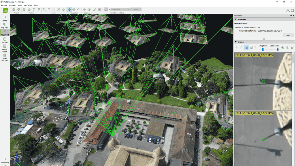
- Streamline data selection & rayCloud navigation.
- Review Point Cloud Classification steps, with focus on Ground and Road Surface classes.
Agenda
February 2-3 , 9:00 AM – 5:30 PM
Pix4Dmapper Essentials
Lecture
- Introduction to photogrammetry
- Collecting ground control points
- Planning a drone flight with Pix4Dcapture
- Introduction to checkpoints
- Analyze Pix4Dmapper’s Quality Check Table
Practical Exercises
- Launch Pix4Dmapper Desktop
- Open a Pix4Dmapper Desktop project
- Create a Pix4Dmapper Desktop project
- Georeference with the Basic GCP/MTP Editor
- Calibrate the camera
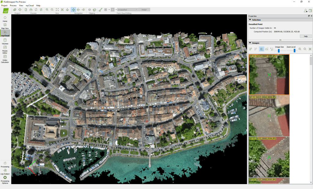
- Georeference with the rayCloud
- Generate the dense point cloud
- Edit the dense point cloud
- Generate the orthomosaic
- Edit the orthomosaic
- Measure in Pix4Dmapper Desktop
- Create a Pix4Dmapper Cloud project
- Measure in Pix4Dmapper Cloud
- Create a custom Pix4Dmapper Cloud project
- Share Pix4Dmapper Desktop deliverables
- Share Pix4Dmapper Cloud deliverables
February 4, 9:00 AM – 5:30 PM
Processing Large Datasets with Pix4Dmapper
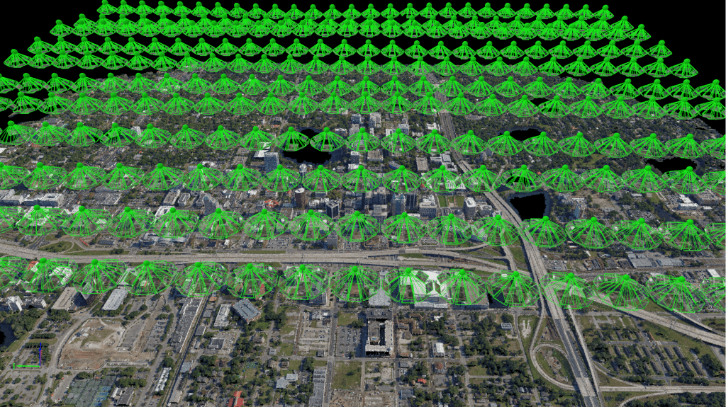
- Conducting multiple battery swaps with one drone
- Flying multiple drones over one area of interest
- Processing a large dataset as one project
- Merging multiple sub-projects with manual tie-points
- Where to place checkpoints and ground control points throughout the project
- The importance of data organization
February 5, 9:00 AM – 5:30 PM
rayCloud Editing Tips & Tricks
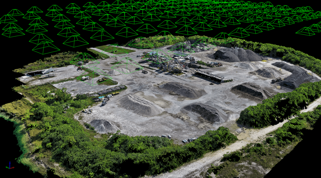
- Introduction
- Point Cloud Examples
- Data capture suggestions
- Processing Options review
- Point cloud classification
- Point cloud editing tools

Participation fee:
1. Basic level Pix4Dmapper Essentials – 2 days – AED 5500
2. Advanced level Pix4Dmapper Essentials + Processing Large Datasets with Pix4Dmapper – 3 days – AED 8250
3. Professional Level Pix4Dmapper Essentials + Processing Large Datasets with Pix4Dmapper + rayCloud Editing Tips & Tricks – 4 days – AED 11000
Registration
After successful registration, you will be redirected to the checkout page.