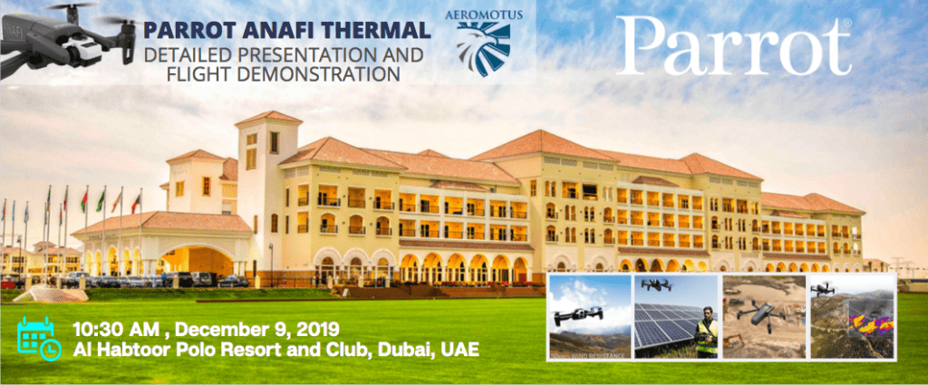
PARROT ANAFI THERMAL TECHNICAL DAY.
DETAILED LOOK AND DEMO FLIGHTS.
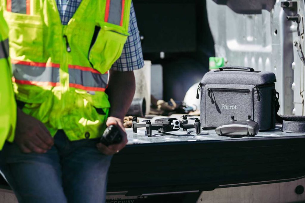
Thanks to rapid advancements in the safety, intelligence, and user-friendliness of modern-day drones, government and commercial sectors are adopting drone technology into their operations more than ever to increase the efficiency of operations, cut down on expenses, and keep workers safe. Once solely known as a consumer-oriented hobby, the usage of drones has expanded into a wide range of areas and has just begun to scratch the surface of its full potential. Today, more and more commercial and government sectors are taking advantage of this rapidly advancing technology, and tackling old problems in an all-new way. The potential uses drones have for various government applications at all levels is limitless. From performing regular safety inspections on infrastructure such as roads, bridges and power lines, to carrying out potentially life-saving public safety missions, the right drone can make all the difference in optimizing operations across a huge scope of different government sectors.
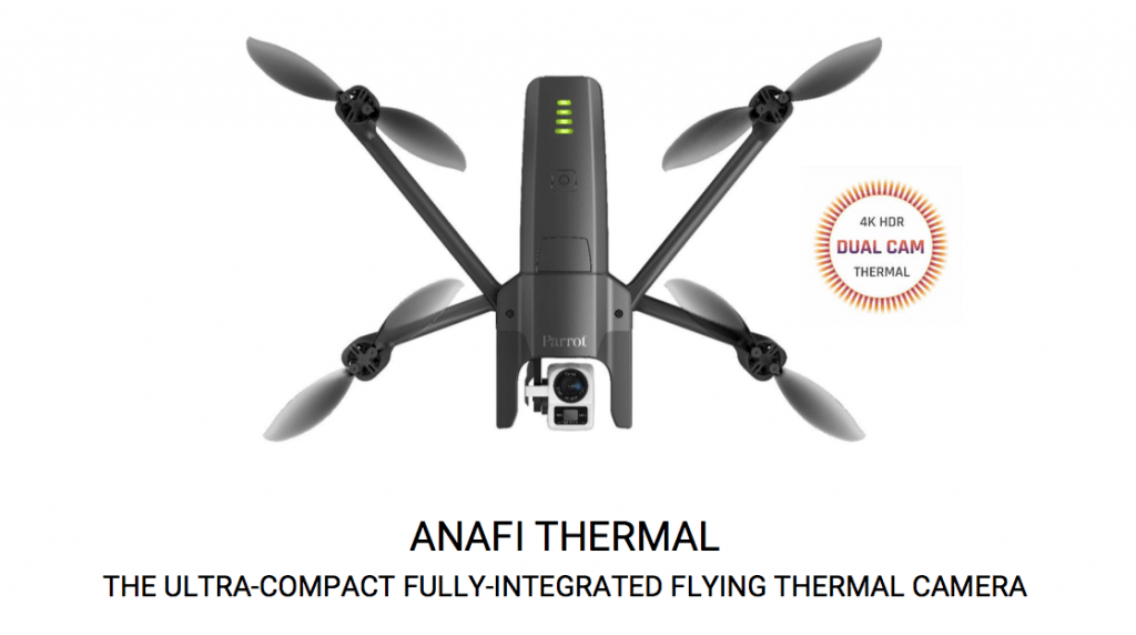
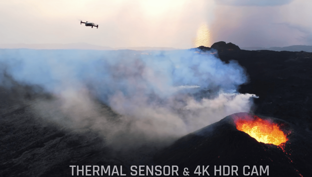
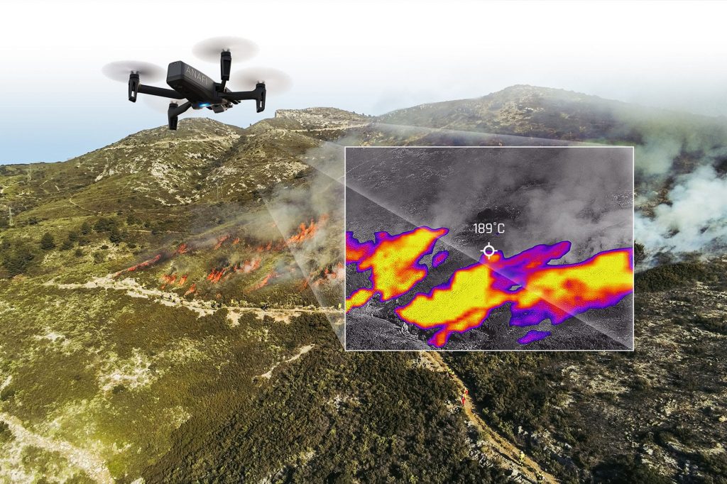
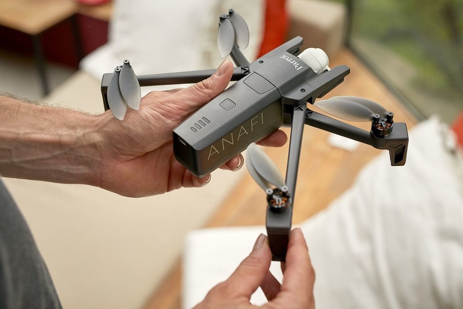
ANAFI THERMAL – THE ULTRA-COMPACT THERMAL DRONE
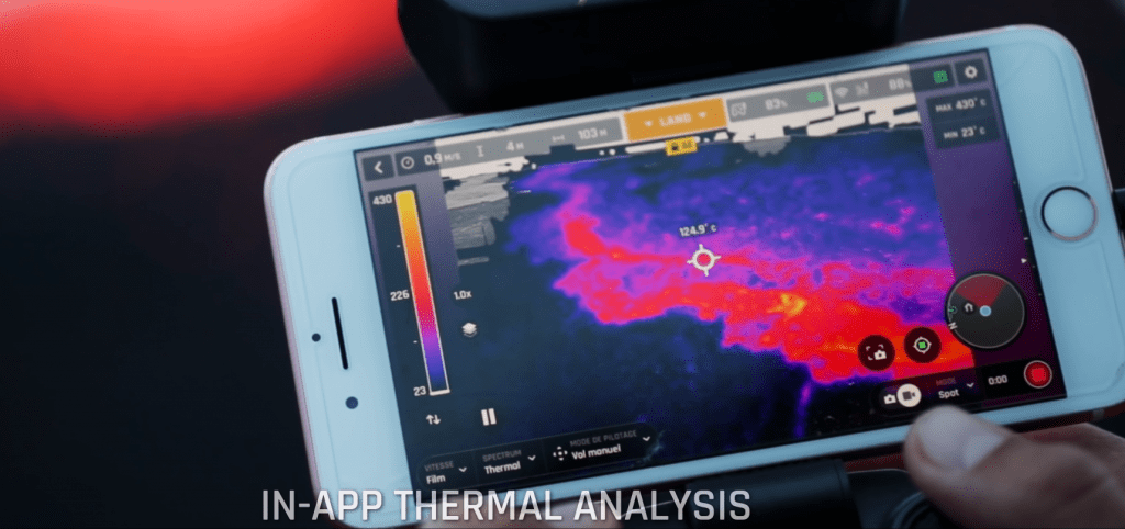
ANAFI Thermal is a fully-integrated, ultra-compact flying thermal camera. Built to provide professionals with the best of two worlds, thermal and visible, ANAFI Thermal features two combined sensors for a dual imagery, boasts optimized flight performances in an all-in-one, ultra-portable solution and is easy-to-use thanks to a user-friendly interface designed to capture and analyse thermal and RGB data.
REGISTRATION FORM:
10:30 AM , December 9, 2019 Al Habtoor Polo Resort and Club, Dubai, UAE
The use of drones or Unmanned Aerial Vehicles (UAVs) in government applications has the potential to dramatically alter several industries, and, in the process, change our attitudes and behaviors regarding their impact on our daily lives.
Over the last few years, drones have grown to become an important tool in the operations of various governmental organizations. Today, more and more government agencies are beginning to see the advanced and practical uses for drones in specific fields and applications ranging from search and rescue operations to on-site infrastructure monitoring. Many cities around the world are already using drones to assist in various operations and departments, from law enforcement to firefighting, infrastructure, tourism, agriculture, and energy.
PUBLIC SAFETY:
DRONE SEARCH AND RESCUE
Fire departments are seeing large benefits from the use of drones during structure fires and search and rescue missions. In the case of a structure fire, when first arriving on the scene, the drone can be deployed to assess the scene, before the firefighters are put in harms way. When equipped with a thermal camera, Parrot Anafi Thermal can show operators where the hotspots are, and also have the ability to see through smoke and in low light conditions. The thermal camera can then allow operators to monitor crew members and conditions, improving efficiency and safety. After the smoke has cleared, drones can also aid in the critical work of assessing the damage, whether it be from a fire or other natural disasters. Parrot Anafi Thermal allows firefighters to quickly and effectively scout out dangerous fires, observe and monitor a large blaze and the surrounding area and more
The health and safety benefits of using drones cannot be understated and when matched with cost savings, there is a forceful argument to incorporate them into police, fire department, military , surveying and construction companies. Drones have the potential to be sent into one-way environments too. Send a drone in to a hazardous environment that is streaming the data back as it flies and while the drone may be lost at a small cost, the back up team can be acting on the information and no person is put at risk. This has huge implications for environments involving fires, radiation and chemical accidents.
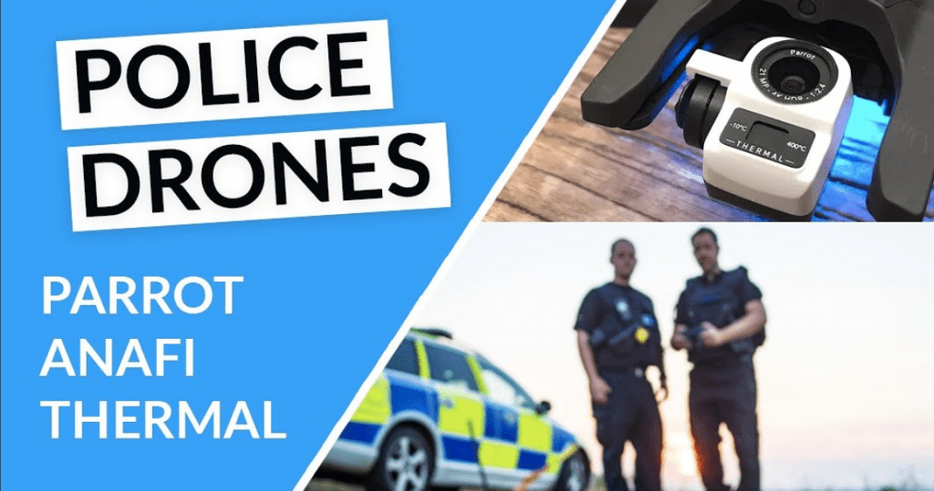
POLICE
There are many ways that police departments can make use of the incredible potential of drones. From keeping police officers out of harm’s way, to helping them achieve results not possible in any other way, drones are going a long way to help make our society safer. Search and Rescue – The first and most obvious use for drones by police agencies is search and rescue. Drones can cover territory much more quickly and efficiently than officers can on foot or even by vehicle. Moreover, drones can get under tree cover, or between buildings, to access places that helicopters can’t. When equipped with a thermal camera, a drone can easily spot a lost or missing person hidden under rubble, undergrowth or even at night. Tracking – Police drones can be used to aid in apprehending criminals on the run. With object tracking capabilities, the drone can track and follow an individual fleeing the scene of a crime, and provide information on the entire scenario, allowing officers to more safely apprehend the suspect. Officer Safety – An aerial perspective can provide vital information in dangerous situations such as active shooter scenes, or in investigation of illegal operations. The eyes in the sky can assess the situation, getting both the big picture, and even down to minute detail with zoom cameras, while increasing the safety of law enforcement officers. High-risk traffic stops also can be made safer by the use of drones. In situations where a suspect is refusing to get out of a vehicle, the officers can deploy a drone to assess the situation or even broadcast recorded messages, while keeping at a safe distance. Monitoring – Drones can serve a vital role in crowd monitoring as well, allowing operators to scan the entire scene for suspicious behavior, or to locate individuals in distress.
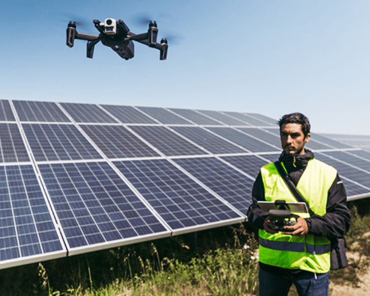
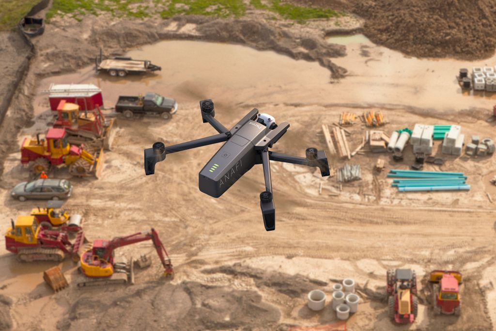
SURVEYING & CONSTRUCTION MONITORING
When commercial drones were first introduced, the construction industry immediately adopted them. Equipped with different types of sensors and cameras, drones were turned into flying data collection devices. It soon became obvious that drones could optimize workflows, improve safety, project results and realize considerable cost savings.
Monitor Progress
Monitor and track productivity on all your large-scale and small-scale construction projects with detailed aerial views with high quality, recorded and live updates.
Construction Site Surveys
Collect comprehensive data for site planning and modeling. Offer cost-effective volume calculations and analysis. Identify challenges and opportunities presented by the terrain to assist every phase of a construction project.
Inspections & Mapping
Inspections for buildings, bridges, roadways, railroads, roofs, cell towers, cooling towers, oil and gas infrastructure, solar and wind farms
Thermographic Imaging
Thermal imaging to detect leaks, faulty structures and energy loss in the fraction of the time it would take to manually inspect a property.