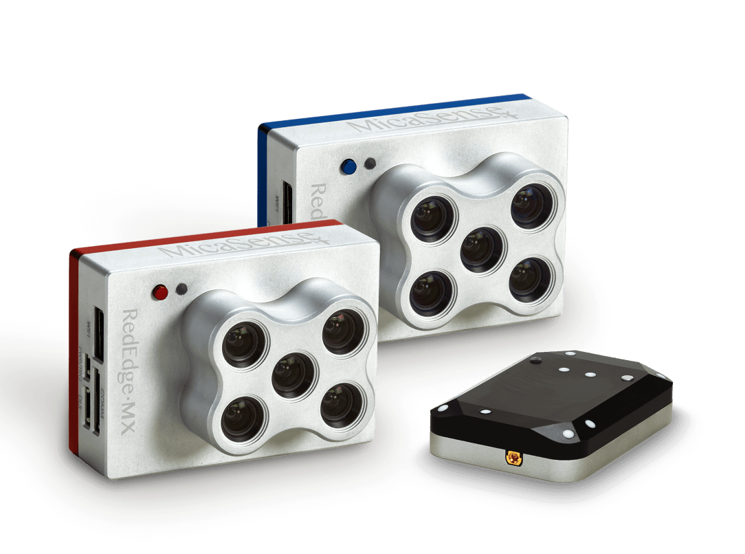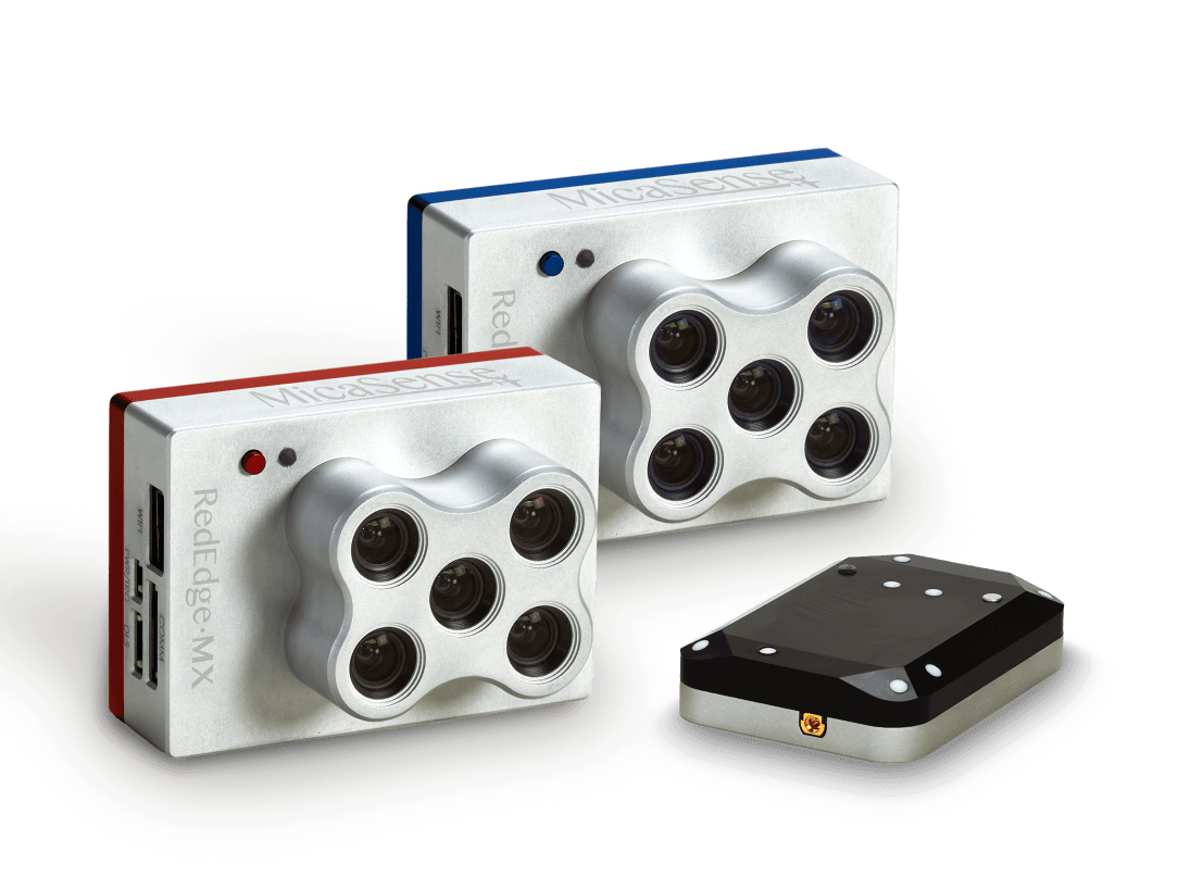
RedEdge-MX Dual Camera Imaging System by MicaSense

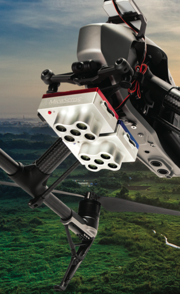
Two five-band cameras, the RedEdge-MX and the new RedEdge-MX blue, this solution enables the most advanced remote sensing and vegetation research applications.

  • Synchronized capture of all 10 bands for pixel aligned imagery
  • Standard 12 bit TIFF file outputs with embedded metadata for full access to raw data
  • Combined Downwelling Light Sensor and GPS for streamlined integration, accurate ambient light calibration. Only one DLS required.
  • Radiometrically calibrated spectral imagers for precise, repeatable measurements
  • Global shutters on all 10 lenses for distortion-free results on every platform

DOUBLE THE SPECTRAL RESOLUTION.
HALF THE HASSLE.

Integrating two five-band cameras, the RedEdge-MX and the new RedEdge-MX blue, this solution enables the most advanced remote sensing and vegetation research applications.

THE NEW REDEDGE-MX BLUE SENSOR

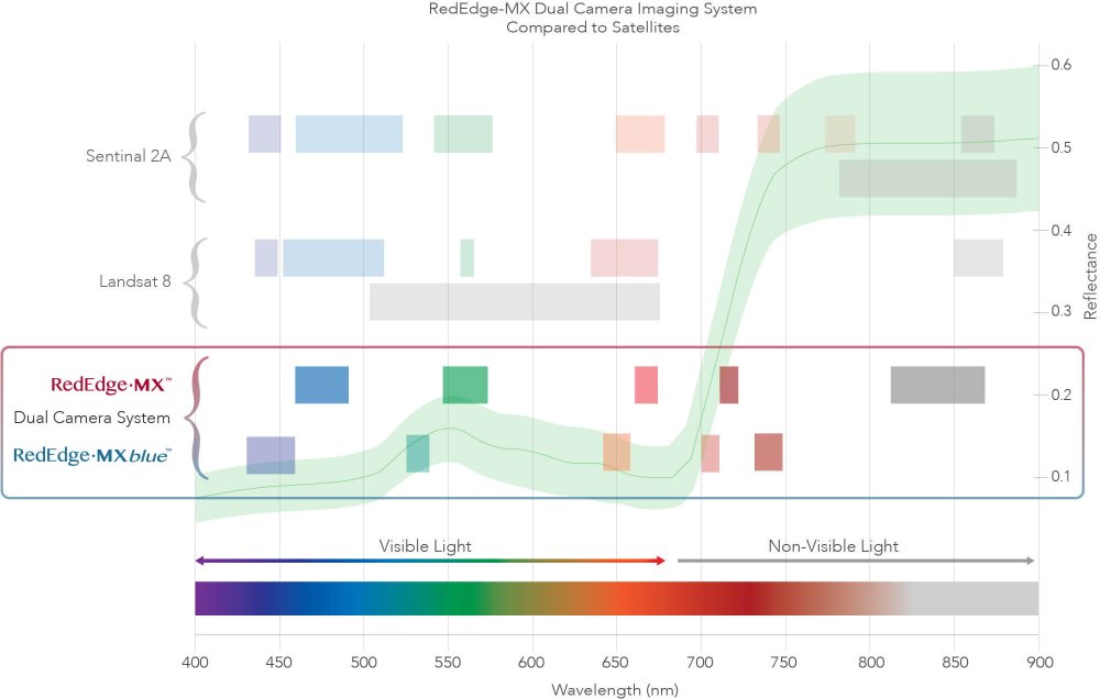
The performance you rely on from RedEdge-MX with a new coastal blue band, a new green band, and three new bands in the red to red-edge region of the spectrum. Combined with the bands in RedEdge-MX, the 10 bands in the Dual Camera System enable direct comparison between satellite and drone data. Already have a RedEdge-M or RedEdge-MX? Buy the new RedEdge-MX blue kit and get double the spectral resolution.

DIRECT DATA COMPARISON BETWEEN SATELLITE AND DRONE IMAGERY

FEATURES OF RedEdge-MX Dual Cameramicasense-rededge-mx-dual-camera-system

  • Synchronized capture of all 10 bands for pixel aligned imagery
  • Standard 12 bit TIFF file outputs with embedded metadata for full access to raw data
  • Combined Downwelling Light Sensor and GPS for streamlined integration, accurate ambient light calibration. Only one DLS required.
  • Radiometrically calibrated spectral imagers for precise, repeatable measurements
  • Global shutters on all 10 lenses for distortion-free results on every platform
  • Comes standard with fixed bracket and quick-mount connector for easy integration

BENEFITS

  • Compare imagery directly with Landsat and Sentinel satellite data
  • Data is easily processed using Pix4D, Agisoft, and other MicaSense data partners
  • Double the bands for double the analytical capabilities
  • Monitor shallow water environments with the new coastal blue aerosol band
  • Perform detailed analysis on chlorophyll efficiency with new red, green, and two new red edge bands strategically located on the red edge slope

RedEdge-MX Dual Camera System Specifications

Weight 508.8 g
(Two sensors, Dual Cam Mount, DLS2, and cable)
Dimensions 8.7cm x 12.3cm x 7.6cm (3.4in x 4.8in x 3.0in)
External Power 4.2 V DC – 15.8 V DC
Power Input 8.0/16.0W (nominal, peak)
Provided through Dual Camera Mount
Spectral Bands Coastal blue 444(28)*, blue 475(32), green 531(14)*, green 560(27), red 650(16)*, red 668(14), red edge 705(10)*, red edge 717(12), red edge 740(18)*, NIR 842(57)
RGB Color Output 3.6 MP (global shutter, aligned with all bands)
Sensor Resolution 1280 x 960 (1.2 MP per EO band)
Ground Sample Distance (GSD): 8 cm per pixel (per band) at 120 m (~400 ft) AGL
Capture Rate 1 capture per second (all bands), 12-bit RAW
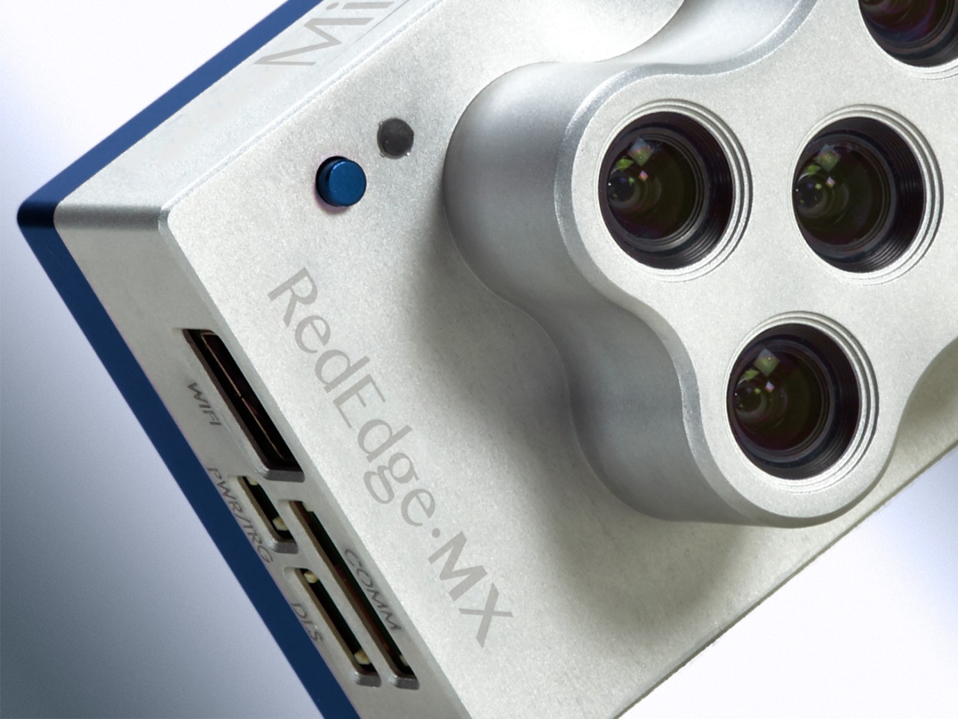
Interfaces Serial, 10/100/1000 ethernet, removable Wi-Fi, external trigger, GPS, SDHC
Field of View 47.2° HFOV
Heat 0-40C ambient (no airflow); 0-50C ambient with
airflow >0.5m/s
Triggering Options Timer mode, overlap mode, external trigger mode (PWM, GPIO, serial, and Ethernet options), manual capture mode

FLY

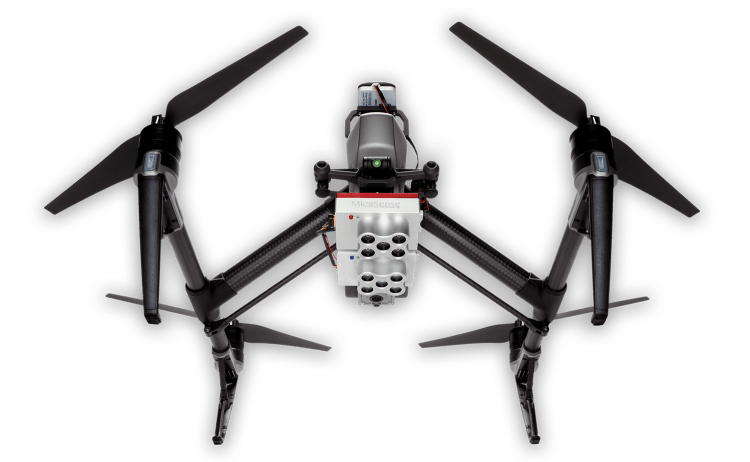
Flying with two cameras is as easy as flying with one. This solution is compatible with a wide range of aircraft, from large fixed wings to small multirotors, and comes standard with an integration kit for DJI drones.

PROCESS

Because the two cameras are both versions of RedEdge-MX, flight planning and data processing can be done with industry-standard tools like Pix4D and Agisoft.

ANALYZE

Double the bands mean double the analytical capabilities. This solution captures synchronized, pixel-aligned imagery which allows the bands from both cameras to be used interchangeably for the creation of more indices.

Matrice 350 RTK

An upgraded flagship drone platform, the Matrice 350 RTK sets a new benchmark for the industry. This next-generation drone platform features an all-new video transmission system and control experience, a more efficient battery system, and more comprehensive safety features, as well as robust payload and expansion capabilities. It is fully powered to inject innovative strength into any aerial operation.

Buy
GPR system: Radar Systems Zond Aero LF (low frequency)

Extra-lightweight GPR system, suitable for medium-sized drones like DJI M300 RTK.

Comes with 3x sets of dipoles for the 300, 150, and 100 MHz.

Utilizes Real Time Sampling (RTS) with high hardware stacking, delivering high-resolution low-noise data.

Buy
Laser Falcon methane detector

Laser Falcon is sensitive only to methane, so no false readings of other gases are possible. It is a class 3R eye-safe laser.

The concept is based on Infrared Absorption Spectroscopy. The laser emits light (spectral range of 1,65 μm), which reflects back and is captured by the sensor. The outgoing and incoming signals are compared with the built-in reference cell. If methane is present along the laser path, the laser light is partially absorbed. An algorithm calculates the gas concentration in ppm×m (parts per million multiplied by meter). The value is instantly transferred to the remote control (RC) of the drone pilot and to UgCS software.

Buy

Inquire price for

    ×