DJI Mavic 3 Multispectral

Effective aerial surveying needs to see the invisible. That’s why Mavic 3 Multispectral has two forms of sight. It combines an RGB camera with a multispectral camera to scan and analyze crop growth with total clarity. Agricultural production management requires precision and data, and Mavic 3M delivers both.

Category

See More, Work Smarter

Effective aerial surveying needs to see the invisible. That’s why Mavic 3 Multispectral has two forms of sight. It combines an RGB camera with a multispectral camera to scan and analyze crop growth with total clarity. Agricultural production management requires precision and data, and Mavic 3M delivers both.

Compact and portable

Foldable for easy storage

Multispectral Camera

4 × 5MP G/R/RE/NIR

RGB camera

20 MP 4/3 CMOS, mechanical shutter

Safe and stable

Omnidirectional Obstacle Avoidance [1] 15km Transmission Distance [2]

Precise positioning

Centimeter-level RTK positioning Microsecond-level time synchronization

Efficient aerial surveying

Up to 200 hectares per flight [3]

Multispectral + RGB imaging system

Highly integrated imaging system

Newly upgraded imaging system with one 20MP RGB camera and four 5MP multispectral cameras (green, red, red edge, and near infrared). Enables applications such as high-precision aerial surveying, crop growth monitoring, and natural resource surveys.

RGB camera characteristics

4/3 CMOS

20MP image sensor

1/2000s

Fastest mechanical shutter speed

0.7s

High-speed burst when RGB camera is used

Sunlight Sensor

The built-in sunlight sensor captures solar irradiance and records it in an image file, allowing for light compensation of image data during 2D reconstruction. This results in more accurate NDVI results, as well as improved accuracy and consistency of data acquired over time.

RTK module

Accurate images that capture every pixel

Mavic 3M with RTK module for centimeter-level positioning. Flight control, the camera, and the RTK module sync in microseconds to accurately capture the location of each camera’s imaging center. This enables Mavic 3M to do high-precision aerial surveying without using ground control points.

Efficient and reliable battery life

Newly upgraded imaging system with one 20MP RGB camera and four 5MP multispectral cameras (green, red, red edge, and near infrared). Enables applications such as high-precision aerial surveying, crop growth monitoring, and natural resource surveys.

Ultra-long battery life, fast bursts

43 minutes
Cruise time
200 hectare
A single flight can complete mapping operations over an area of 200 hectares.
Play Video

Fast charging

100W Battery Charging Hub

High-efficiency fast charging

88W fast charging

Aircraft

Stable signal, smooth image transmission

The O3 transmission integrates two transmitting signals and four receiving signals to support 15km ultra-long transmission distances.
Play Video

Omnidirectional obstacle sensing, terrain-follow aerial surveying

The aircraft features multiple wide-FOV vision sensors that accurately detect obstacles in all directions for omnidirectional obstacle avoidance. The terrain-follow aerial surveying can be easily performed in steep-slope landscapes.
Play Video

Applications

Orchard mapping

Mavic 3M allows terrain-follow aerial surveying of orchards, even on sloped landscapes. Together with DJI Terra or DJI SmartFarm Platform [6] to reconstruct high-resolution orchard maps, automatically identify the number of trees, distinguish trees from other obstacles or objects, and generate three-dimensional operation routes for agricultural drones, making operations safer and more efficient.

Guide variable rate applications

For rice fertilization, cotton growth regulation, and potato foliar fertilizer spraying, the Mavic 3M is used to obtain multi-spectral images of crops. DJI Terra or the DJI SmartFarm Platform [6] can then generate NDVI and other vegetation indices maps, capturing differences in crop potential and generating prescription maps that allow agricultural drones to execute variable-rate application. This ultimately allows users to reduce costs, increase yield, and protect the environment.

Intelligent field scouting

The Mavic 3M can carry out automatic field scouting. The field scout images can be uploaded to the DJI SmartFarm Platform [6] in real time through a 4G network. It can find abnormalities, such as emergence deficiencies, weed pressure, and crop lodging in a timely manner. It can also conduct intelligent analyses, such as cotton seedling identification and rice production testing, using AI identification for real-time sharing of crop growth information, guidance of agronomic activities, and easy management of 70 hectares of farmland by one person.

Environmental Monitoring and Natural Resources Survey

The Mavic 3M can also be used in environment and natural resource surveys, such as water enrichment monitoring, forest distribution surveys, urban green area surveys, and more.
Category:

Aircraft

Net Weight (with propellers and RTK module) [1] 951 g
Max Takeoff Weight 1,050 g
Dimensions (Folded/Unfolded) Folded (without propellers): 223×96.3×122.2 mm (Length×Width×Height)
Unfolded (without propellers): 347.5×283×139.6 mm (Length×Width×Height)
Diagonal Length Diagonal: 380.1 mm
Max Ascent Speed 6 m/s (Normal Mode)
8 m/s (Sport Mode)
Max Descent Speed 6 m/s (Normal Mode)
6 m/s (Sport Mode)
Max Flight Speed (at sea level, no wind) 15 m/s (Normal Mode)
Flying forward: 21 m/s, flying sideways: 20 m/s, flying backwards: 19 m/s (Sport mode) [2]
Max Wind Speed Resistance 12 m/s [3]
Max Take-off Altitude Above Sea Level 6000 m (without a payload)
Max Flight Time (without wind) 43 minutes [4]
Max Hover Time (without wind) 37 minutes [4]
Max Flight Distance 32 km [6]
Max Tilt Angle 30° (Normal Mode)
35° (Sport Mode)
Max Angular Velocity 200°/s
GNSS GPS + Galileo + BeiDou + GLONASS (GLONASS is supported only when RTK module is enabled)
Hovering Accuracy Range Vertical: ±0.1 m (Vision Positioning enabled); ±0.5 m (GNSS Positioning enabled); ±0.1 m (D-RTK enabled)
Horizontal: ±0.3 m (Vision Positioning enabled); ±0.5 m (HD Positioning enabled); ±0.1 m (RTK enabled)
Operating Temperature -10° to 40° C (14° to 104° F)
Internal Storage N/A
Motor Model Number 2008
Propeller Model Number 9453F Enterprise Edition
Light Sensor Built-in module

RGB Camera

Image Sensor 4/3 CMOS
Effective Pixels: 20 MP
Lens FOV: 84°
Equivalent focal length: 24 mm
Aperture: f/2.8 to f/11
Focus: 1 m to ∞
ISO Range 100-6400
Shutter speed Electronic shutter: 8-1/8000 s
Mechanical shutter: 8-1/2000 s
Max Image Size 5280×3956
Photo Shooting Mode Single shot: 20 MP
Timelapse: 20 MP
JPEG: 0.7/1/2/3/5/7/10/15/20/30/60 s
JPEG + RAW: 3/5/7/10/15/20/30/60 s
Panorama: 20 MP (original material)
Video Resolution H.264:
4K: 3840×2160@30fps
FHD: 1920×1080@30fps
Max Video Bitrate 4K: 130Mbps
FHD: 70Mbps
Supported File System exFAT
Image Format JPEG/DNG (RAW)
Video Format MP4 (MPEG-4 AVC/H.264)

Multispectral Camera

Image Sensor 1/2.8-inch CMOS, effective pixels: 5 MP
Lens FOV: 73.91° (61.2° x 48.10°)
Equivalent focal length: 25 mm
Aperture: f/2.0
Focus: Fixed Focus
Multispectral Camera Band Green (G): 560 ± 16 nm;
Red (R): 650 ± 16 nm;
Red Edge (RE): 730 ± 16 nm;
Near infrared (NIR): 860 ± 26 nm;
Gain Range 1x-32x
Shutter Speed Electronic Shutter: 1/30~1/12800 s
Max Image Size 2592×1944
Image Format TIFF
Video Format MP4 (MPEG-4 AVC/H.264)
Photo Shooting Mode Single shot: 5 MP
Timelapse: 5 MP
TIFF: 2/3/5/7/10/15/20/30/60 s
Video Resolution H.264
FHD: 1920 x 1080@30fps
Video content: NDVI/GNDVI/NDRE
Max Video Bitrate Stream: 60 Mbps

Gimbal

Stabilization System 3-axis mechanical gimbal (tilt, roll, pan)
Mechanical Range Tilt: -135° to 45°
Roll: -45° to 45°
Pan: -27° to 27°
Controllable Range Tilt: -90° to 35°
Pan: Uncontrollable
Max Control Speed (tilt) 100°/s
Angular Vibration Range ±0.007°

Sensing System

Sensing System Type Omnidirectional binocular vision system, with an infrared sensor at the bottom of the aircraft
Forward Distance Measuring Range: 0.5 m to 20 m
Detection Range: 0.5 m to 200 m
Effective Obstacle Avoidance Speed: Flight Speed ≤15 m/s
FOV: Horizontal 90°, vertical 103°
Backward Distance Measuring Range: 0.5 m to 16 m
Effective Obstacle Avoidance Speed: Flight speed ≤12 m/s
FOV: Horizontal 90°, vertical 103°
Lateral Distance Measuring Range: 0.5 m to 25 m
Effective Obstacle Avoidance Speed: Flight speed ≤15 m/s
FOV: Horizontal 90°, vertical 85°
Upward Distance Measuring Range: 0.2 m to 10 m
Effective Obstacle Avoidance Speed: Flight Speed ≤6 m/s
FOV: Front and rear 100°, left and right 90°
Downward Distance Measuring Range: 0.3 m to 18 m
Effective Obstacle Avoidance Speed: Flight speed ≤6 m/s
FOV: Front and rear 130°, left and right 160°
Operating Environment Front, Rear, Left, Right, Above: Surfaces with clear patterns and adequate lighting (> 15 lux, environments with normal indoor fluorescent light exposure)
Below: Surfaces with diffuse reflection material and a reflectivity of >20% (such as walls, trees, people, etc.); Adequate lighting (>15 lux, environments with normal indoor fluorescent light exposure)

Video Transmission

Video Transmission System DJI O3 Image Transmission Industry Edition
Live View Quality Remote Controller: 1080p/30fps
Operating Band [7] 2.400-2.4835 GHz
5.725-5.850 GHz
Max Effective Signal Distance (Unobstructed, No interference) [8] FCC: 15 km
CE: 8 km
SRRC: 8 km
MIC: 8 km
Max Transmission Distance (Obstructed) [9] Strong Interference (urban landscapes, residential areas, etc.): 1.5-3 km (FCC/CE/SRRC/MIC)
Medium Interference (suburban landscapes, city parks, etc.): 3-9 km (FCC), 3-6 km (CE/SRRC/MIC)
Weak Interference (remote fields, open farmland, etc.): 9-15 km (FCC), 6-8 km (CE/SRRC/MIC)
Max Download Speed 15 MB/s (with DJI RC Pro Industry Edition)
Latency (depending on environment and mobile device) Approximately 200 milliseconds
Antennas 4 antennas, 2 transmitting and 4 receiving
Transmitter Power (EIRP) 2.4 GHz: <33 dBm (FCC), <20 dBm (CE/SRRC/MIC)
5.8 GHz: <33 dBm (FCC), <30 dBm (SRRC), <14 dBm (CE)
Other Supports the DJI Cellular module

DJI RC Pro Enterprise Edition

Image Transmission System DJI O3 Image Transmission Industry Edition
Max Effective Signal Distance (Unobstructed, No interference) [8] FCC: 15 km
CE: 8 km
SRRC: 8 km
MIC: 8 km
Operating Band of Image Transmission [7] 2.400-2.4835 GHz
5.725-5.850 GHz
Antennas 4 antennas, 2 transmitting and 4 receiving
Operating Band of Image Transmission and Transmitter Power (EIRP) 2.4 GHz: <33 dBm (FCC); <20 dBm (CE/SRRC/MIC)
5.8 GHz: <33 dBm (FCC); <14 dBm (CE); <23 dBm (SRRC)
Wi-Fi Protocol 802.11 a/b/g/n/ac/ax
Support 2×2 MIMO Wi-Fi
Wi-Fi Operating Band [7] 2.400-2.4835 GHz
5.150-5.250 GHz
5.725-5.850 GHz
Wi-Fi Operating Band and Transmitter Power (EIRP) 2.4 GHz: <26 dBm (FCC); <20 dBm (CE/SRRC/MIC)
5.1 GHz: <26 dBm (FCC); <23 dBm (CE/SRRC/MIC)
5.8 GHz: <26 dBm (FCC/SRRC); <14 dBm (CE)
Bluetooth Protocol Bluetooth 5.1
Bluetooth Operating Band 2.400-2.4835 GHz
Bluetooth Transmitter Power (EIRP) <10 dBm
Screen Resolution 1920×1080
Screen Size 5.5 inches
Screen Frame Rate 60 fps
Screen Brightness 1,000 nits
Touch-Screen 10-point multi-touch
Battery Lithium-ion battery (5000 mAh, 7.2 V)
Charging Type 100W Battery Charging Hub or USB charger with 12V or 15V specifications is recommended
Rated Power 12 Watts
Storage Capacity Internal Memory (ROM): 64 GB
Supports microSD card usage to increase storage capacity
Charging Time Approx. 1.5 hours (measured when only using the 100W Battery Charging Hub to charge the remote control, or when using a 15V USB charger)
Approximately 2 hours (measured using a 12V USB charger)
Approximately 2 hours and 50 minutes (measured using the 100W Battery Charging Hub to charge the aircraft and remote control at the same time)
Operating Time Approx. 3 hours
Video Output Port Mini-HDMI Port
Operating Temperature -10° to 40° C (14° to 104°F)
Storage Temperature Range <1 month: -30° to 60° C (-22° to 140° F)
One to three months: -30° to 45° C (-22° to 113° F)
Three to six months: -30° to 35° C (-22° to 95° F)
More than six months: -30° to 25° C (-22° to 77° F)
Charging Temperature 5° to 40° C (41° to 104° F)
Supported DJI Aircraft [10] DJI Mavic 3E
DJI Mavic 3T
DJI Mavic 3M
GNSS GPS + Galileo + GLONASS
Dimensions Antenna is folded and no control sticks are installed:
183.27×137.41×47.6 mm (Length×Width×Height)
Antenna unfolded and control sticks are installed:
183.27×203.35×59.84 mm (Length×Width×Height)
Weight Approx. 680 g
Model Number RM510B

Storage

Supported microSD Cards Aircraft:
Please use a memory card with a speed rating of V30 or higher, or use a memory card from the recommended list
Recommended microSD Cards Remote Controller:
SanDisk Extreme PRO 64GB V30 A2 microSDXC
SanDisk High Endurance 64GB V30 microSDXC
SanDisk Extreme 128GB V30 A2 microSDXC
SanDisk Extreme 256GB V30 A2 microSDXC
SanDisk Extreme 512GB V30 A2 microSDXC
Lexar 667x 64GB V30 A2 microSDXC
Lexar High-Endurance 64GB V30 microSDXC
Lexar High-Endurance 128GB V30 microSDXC
Lexar 667x 256GB V30 A2 microSDXC
Lexar 512GB V30 A2 microSDXC
Samsung EVO Plus 64GB V30 microSDXC
Samsung EVO Plus 128GB V30 microSDXC
Samsung EVO Plus 256GB V30 microSDXC
Samsung EVO Plus 512GB V30 microSDXC
Kingston Canvas Go! Plus 128GB V30 A2 microSDXC
Kingston Canvas React Plus 128GB V90 A1 microSDXCAircraft:
SanDisk Extreme 32GB V30 A1 microSDHC
SanDisk Extreme PRO 32GB V30 A1 microSDHC
SanDisk Extreme 512GB V30 A2 microSDXC
Lexar 1066x 64GB V30 A2 microSDXC
Kingston Canvas Go! Plus 64GB V30 A2 microSDXC
Kingston Canvas React Plus 64GB V90 A1 microSDXC
Kingston Canvas Go! Plus 128GB V30 A2 microSDXC
Kingston Canvas React Plus 128GB V90 A1 microSDXC
Kingston Canvas React Plus 256GB V90 A2 microSDXC
Samsung PRO Plus 256GB V30 A2 microSDXC

Battery

Capacity 5000 mAh
Standard Voltage 15.4 V
Max Charging Voltage 17.6 V
Battery Type LiPo 4S
Chemical System Lithium Cobalt
Energy 77 watt-hours
Weight 335.5 g
Charging Temperature 5° to 40° C (41° to 104° F)

Battery Charger

Charging Hub

Input 100V to 240V (AC), 50Hz to 60Hz, 2.5A
Output Power 100 Watts
Output Maximum output power of 100 Watts (total)
When both the ports are used, the maximum output power of one interface is 82 W, and the charger will dynamically allocate the output power of the two interfaces according to load power.
Input USB-C: 5V to 20V, 5.0A
Output Battery Port: 12V to 17.6V, 8.0A
Rated Power 100 Watts
Charging Type 3 batteries on charging rotation
Charging Temperature 5° to 40° C (41° to 104° F)

RTK Module

Dimensions 50.2×40.2×66.2 mm (Length×Width×Height)
Weight 24±2 g
Interface USB-C
Power Approximately 1.2 watts
RTK Position Accuracy Fixed RTK:
Horizontal: 1 cm + 1 ppm; Vertical: 1.5 cm + 1 ppm

Notes

Footnotes 1. Standard weight of the aircraft (including battery, propellers, and microSD card). The actual product weight may vary due to differences in batch materials and external factors. Use for reference only.
2. The max speed in the EU cannot exceed 19 m/s.
3. Max wind resistance during takeoff and landing.
4. Data measured using the DJI Mavic 3M in a wind-free environment while flying at sea level at a constant speed of 36 kph until there was 0% power remaining. For reference only. Please pay attention to Return to Home prompts in the DJI Pilot 2 app when flying.
5. Data measured using the DJI Mavic 3M in a wind-free environment hovering over the sea level until there was 0% power remaining. For reference only. Please pay attention to Return to Home prompts in the DJI Pilot 2 app when flying.
6. Data measured using the DJI Mavic 3M in a wind-free environment while flying at sea level at 57.6 kph until there was 0% power remaining. For reference only. Please pay attention to Return to Home prompts in the DJI Pilot 2 app when flying.
7. In some countries, the 5.1/5.8GHz frequencies are prohibited, or the 5.1GHz frequency is only allowed for indoor use. Please refer to local laws and regulations before use.
8. Data measured flying in an unobstructed outdoor environment free of interference. It shows the farthest communication range for one-way, non-Return to Home flights under each standard. Please pay attention to Return to Home prompts in the DJI Pilot 2 app when flying.
9. Data measured in an unobstructed environment with typical interference under various standards. The actual flight distance may vary and is for reference only.
10. The DJI RC Plus will support more DJI aircraft in the future.

Aircraft

What countries/regions is DJI Mavic 3M available for purchase and use?

DJI Mavic 3M is available in Mainland China, North America, and other select regions. For more specific information regarding use and availability, check the official DJI website

What should I be aware of when using the DJI Mavic 3M’s sunlight sensor?

You should avoid blocking the sunlight sensor when it is in use. For example, the vegetation indices, such as NDVI, cannot be obtained when it is blocked. In addition, you should avoid rubbing the sensor, since its performance will be affected if the surface is scratched.

Is DJI Mavic 3M waterproof?

No.

How does DJI Mavic 3M use network RTK services without a 4G network card (including a SIM card)?

You can connect to the network RTK by using Wi-Fi on the remote controller.

Is the DJI Mavic 3M network RTK service bound to the remote controller or the aircraft?

It is bound to the remote controller.

Gimbal Cameras

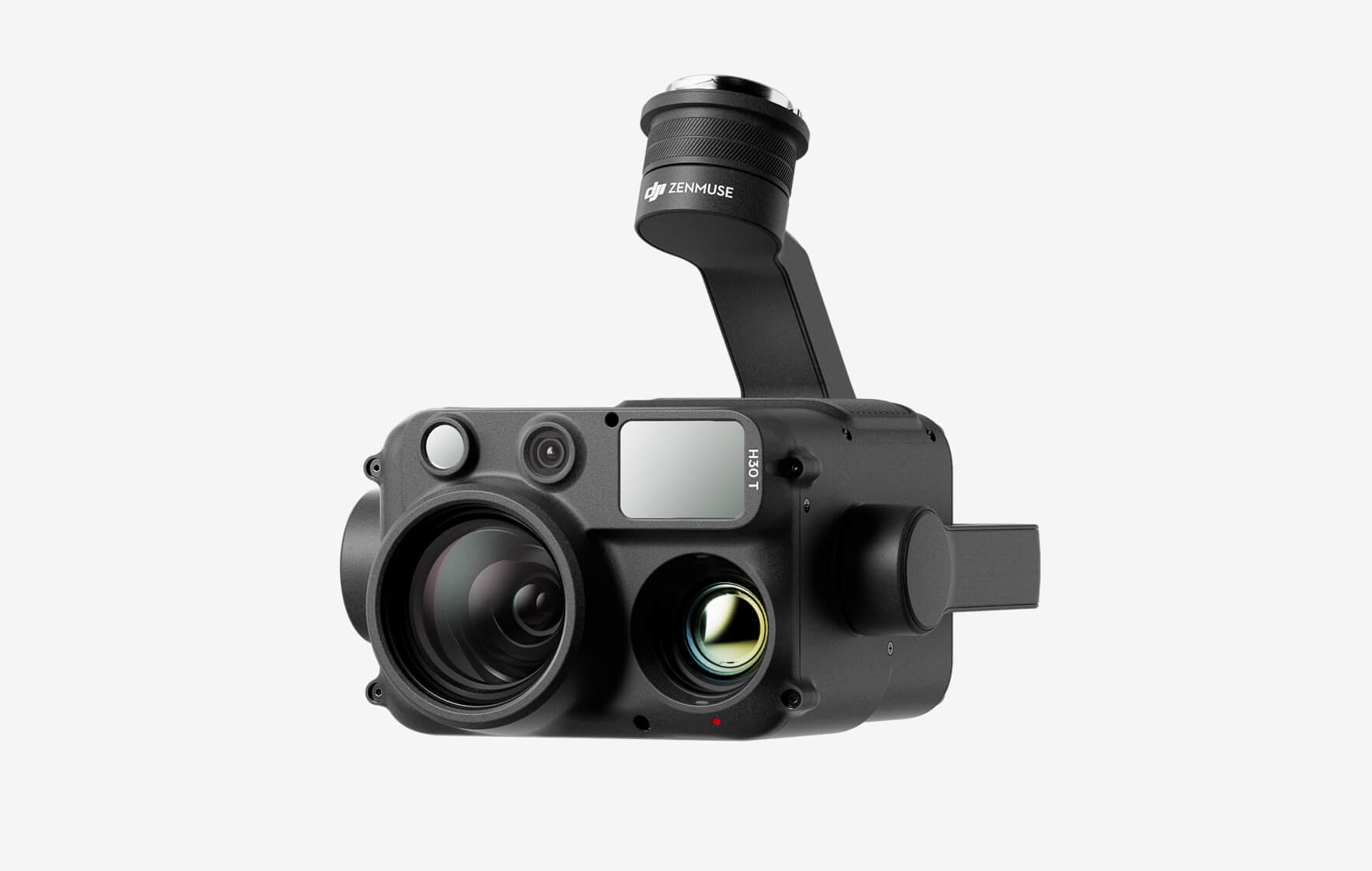
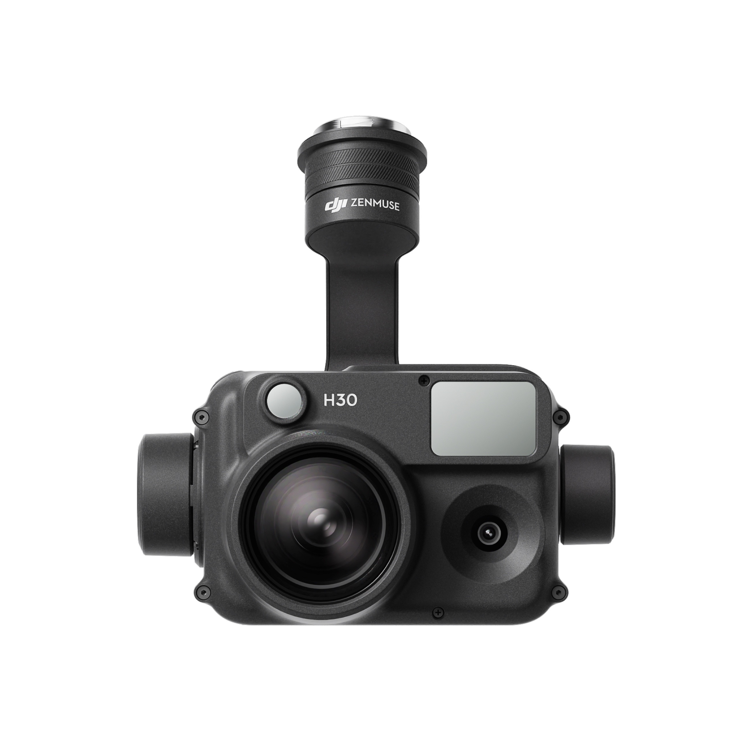
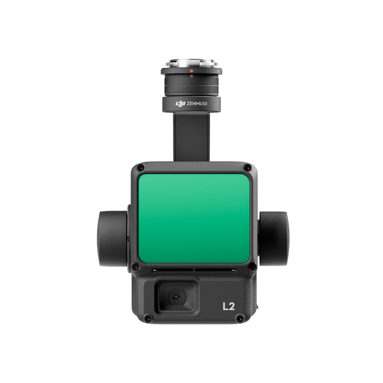
How many cameras does DJI Mavic 3M have? What are the wavelengths for the multispectral cameras?

DJI Mavic 3M features four 5.5MP single-band cameras and one 20MP RGB camera. The single-band cameras are as follows: green (G) 550 nm ± 16 nm, red (R): 650 nm ± 16 nm, Red edge (RE): 730 nm ± 16 nm, and Near-infrared (NIR): 860 nm ± 26 nm.

What is the focal length of each camera of the DJI Mavic 3M Multispectral Camera?

Multispectral focal length: 4.34 mm (focal length); 25 mm (35mm equivalent focal range)
Visible focal length: 12.29 mm (focal length); 24 mm (35mm equivalent focal range)

Is the image taken by DJI Mavic 3M a DN value or a reflectance value?

DN value.

Does DJI Mavic 3M support image position compensation?

Each of the five camera sensor centers has been compensated in the photo EXIF coordinates according to its position relative to the on-board D-RTK antenna phase center. When the images are mapped, the DJI Terra or DJI SmartFarm Platform automatically uses this parameter for position compensation to ensure the accuracy of the map position.

Does the DJI Mavic 3M camera have distortion correction?

Distortions in visible and multispectral cameras are individually corrected before they are shipped.

Does the DJI Mavic 3M camera correct vignetting?

The original photo generated does not come with vignetting correction, but the parameters used for vignetting correction are included with each photograph.

Are the locations of photos taken by DJI Mavic 3M time synced?

All five cameras are time synchronized.

Where are the photos taken by the DJI Mavic 3M camera saved?

The storage paths are as follows. For normal photography: SD card-DCIM-DJI_2022********_***
For flight path operation: SD card-DCIM-DJI_2022********_***_task name

What are the recommended settings for the DJI Mavic 3M camera?

Users who are beginners are recommended to set the exposure mode of the multispectral and visible light camera to Auto and unlock the AE. The multispectral light metering mode of the system is set to global light measurement by default. The focus mode of the visible camera will be First Waypoint Focus.

What does the DJI Mavic 3M Multispectral camera do?

It detects the reflective strength of the object being photographed over different bands and is widely used in agriculture and forestry for crop health, vegetation coverage, water environment pollution monitoring, and more.

Remote Control & Transmission

How far can DJI Mavic 3M transmit images?

  • FCC: 15 km
  • CE: 8 km
  • SRRC: 8 km
  • MIC: 8 km

* The above data was measured by the aircraft in an unobstructed, interference-free outdoor environment. It shows the farthest communication distance for one-way, non-RTH flights under each standard. During flight, pay attention to RTH reminders in the DJI Pilot 2 App.

How much memory does the DJI RC Pro Enterprise Edition have?

The ROM of the remote control is 64GB. For extended storage capacity, microSD card use is also supported.

Does DJI Mavic 3M support MSDK?

Yes.

Does the DJI Cellular module come with a free SIM card?

No. According to real-name requirements, SIM cards must be purchased and activated with the user’s real name.

Does the DJI Cellular module support 5G networks?

No.

What types of SIM cards are recommended?

Nano SIM cards are supported. eSIM SIM cards are not supported.

Is the DJI RC Pro Enterprise Edition compatible with the DJI Phantom 4 RTK, DJI Phantom 4 Multispectral, and the T-Series agricultural drone remote controller?

No.

Does the DJI Mavic 3 Series and DJI Mavic 3 Enterprise Series’ remote controller work with the DJI Mavic 3M aircraft?

The DJI Mavic 3 Series remote controller does not work with Mavic 3M, but the DJI Mavic 3 Enterprise-Series remote controller does.

Battery & Charger

What are the specifications for DJI Mavic 3M’s battery?

5,000 mAh, 15.4 V, 77 Wh.

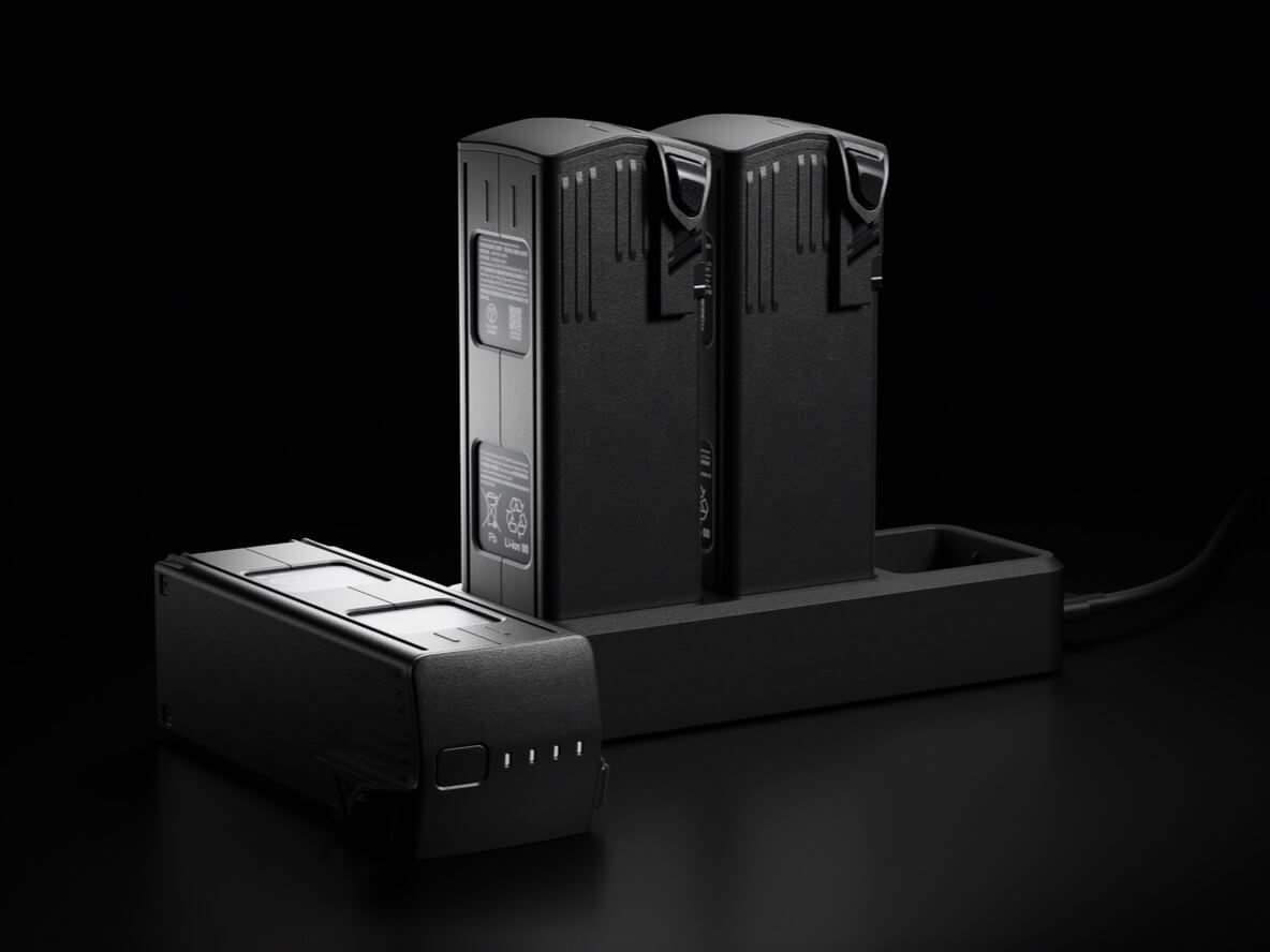
How long does it take to charge the DJI Mavic 3M’s Intelligent Flight Battery?

When used with a DJI 100W USB-C Power Adapter, it takes about 1 hour and 10 minutes to fully charge an Intelligent Flight battery with the DJI Mavic 3M Charging Hub (100 W).
When connecting directly to the aircraft via the DJI 100W USB-C Power Adapter, it takes about 1 hour and 20 minutes to fully charge an Intelligent Flight battery.

How long does a DJI Mavic 3M’s battery last?

43 minutes.
* This data was measured using DJI Mavic 3M in windless conditions at sea level at a constant speed of 36 kph until the battery reached 0%. Use for reference only. Please pay attention to RTH prompts in the DJI Pilot 2 app when flying.

Does the DJI Mavic 3M charger, battery, and charging hub support fast charging protocols (PD/QC/PPS)?

Yes.

Are the batteries for DJI Mavic 3M compatible with DJI Mavic 3 Series and DJI Mavic 3 Enterprise Series aircraft?

Yes.

Which interface of the DJI 100W USB-C Power Adapter does the DJI Mavic 3M’s 100W battery charging hub need to connect to?

It is recommended to connect to the C1 port.

Aerial Surveying and Application

Does DJI Mavic 3M support KML and KMZ file imports and what are the import path requirements?

The DJI Pilot 2 App supports importing polygon boundaries and waypoint missions for pre-planned aerial photography with KML/KMZ files. Import path: Route > KMZ Import > Select Table of Contents > Internal Storage/SD Card > Locate the KML/KMZ file.

Does DJI Mavic 3M support DSM file imports and what are the import path requirements?

The DJI Pilot 2 App supports importing DSM data for terrain follow during aerial surveying. DSM files are imported as follows: Flight Path > Create Flight Path> Mapping Mission > Terrain Follow > DSM File Selection > Select Table of Contents > Internal Storage/SD card > Find DSM File for Import.

Does DJI Mavic 3M support flight path inspection?

Yes. You can schedule a flight path by importing a KMZ or KML file or, create flight path on Pilot 2.

Does DJI Mavic 3M support real-time display of vegetation indices, such as NDVI, through the remote controller?

Yes, the vegetation indices, such as NDVI, can be viewed in real-time on the remote controller during flight.

Does DJI Mavic 3M support dual control?

No.

Does DJI Mavic 3M support multi-aircraft control?

No.

Does DJI Mavic 3M support access to DJI Flighthub 2?

Not currently.

Does DJI Mavic 3M support timelapse, motionlapse, Follow Me, TapFly, or Hyperlapse?

No.

What are DJI Mavic 3M’s flight altitude and speed limitations?

Flight Height: 500 m;
Flight Speed: Maximum horizontal flight speed is 21 m/s, minimum horizontal flight speed is 1 m/s (no wind, near sea level)

How do I check the solar altitude angle of the work area for the corresponding time?

Via https://keisan.casio.com/exec/system/1224682277. Input the corresponding coordinates along with the date and time zone to confirm the sun’s altitude angle changes over time for that day.

How do I determine flight altitude based on the required GSD?

Visible camera (orthophoto): (H/37.2) cm/pixel
Multispectral camera (orthophoto): (H/21.7) cm/pixel

What are the recommended conditions for multispectral data acquisition with DJI Mavic 3M?

The recommended environment for multispectral data acquisition with DJI Mavic 3M is when light conditions are good and the sun’s altitude angle is not less than 30°.

Does DJI Mavic 3M support terrain-follow aerial surveying for orchards with high slopes?

DJI Mavic 3M can directly perform terrain-follow aerial surveying via downward vision. It can also import DSM data for terrain-follow aerial surveying.

Does DJI Mavic 3M support AI Spot-Check?

Yes. You can automate routine inspections and capture consistent results every time. Onboard AI recognizes the subject of interest and identifies it in subsequent automated missions to ensure consistent framing.

Accessory

Which accessories of DJI Mavic 3M are the same as those of DJI Mavic 3?

The Intelligent Flight battery and propeller guard.

Can DJI Mavic 3M be used with DJI Goggles?

No.

Does DJI Mavic 3M support D-RTK2 mobile station?

Yes.

Does DJI Mavic 3M come standard with the RTK Module?

Yes.

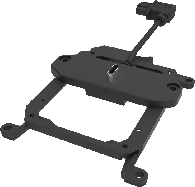
What accessories does the PSDK port on top of the DJI Mavic 3M’s body support?

The PSDK port supports the RTK Module and official DJI Mavic 3 Enterprise Series Speaker

Does DJI Mavic 3M come standard with a charging hub?

Optional. Additional purchase required.

Does the DJI Mavic 3M come standard with a DJI Mavic 3 Enterprise Series Speaker?

Optional. Additional purchase required.

How does the DJI 100W USB-C Power Adapter charge the batteries of DJI RC Pro Enterprise Edition and DJI Mavic 3M?

The DJI 100W USB-C Power Adapter comes with a USB-C power cable that can sustain 100 W of power output. Direct connection to the DJI RC Pro Enterprise Edition has a charging power of 30 W, direct connection to the aircraft has a charging power of 88 W, and direct connection to the charging hub has a charging power of 100 W.

Do DJI Mavic 3M’s accessories support the PD/QC/PPS fast-charging protocol?

The DJI Mavic 3M’s Intelligent Flight battery, DJI 100W USB-C Power Adapter, and DJI Mavic 3 Charging Hub (100 W) all support PD and PPS fast charging protocols. DJI RC Pro Enterprise Edition supports PD and QC protocols.

M30 PSDK ADAPTER BRACKET

The PSDK load can be fixed to the M30 series flight platform, and different types of PSDK loads can be quickly removed and replaced.

Buy
FC30 EQUIPPED WITH A THREE-LOAD SUPPORT

The FC30 EQUIPPED WITH A THREE-LOAD SUPPORT is designed for the DJI FlyCart 30 carrier and can support up to three ET4 FOUR DROP KIT at the same time, achieving 12-stage drops with a maximum payload of 120kg.

Buy
SDK PAYLOAD BRACKET(OSDK)

Extended based on the Warp M350 RTK E-Port interface, the load can be mounted to the belly of the Warp M350 RTK aircraft, supporting up to OT series devices.

Buy

Inquire price for

    ×