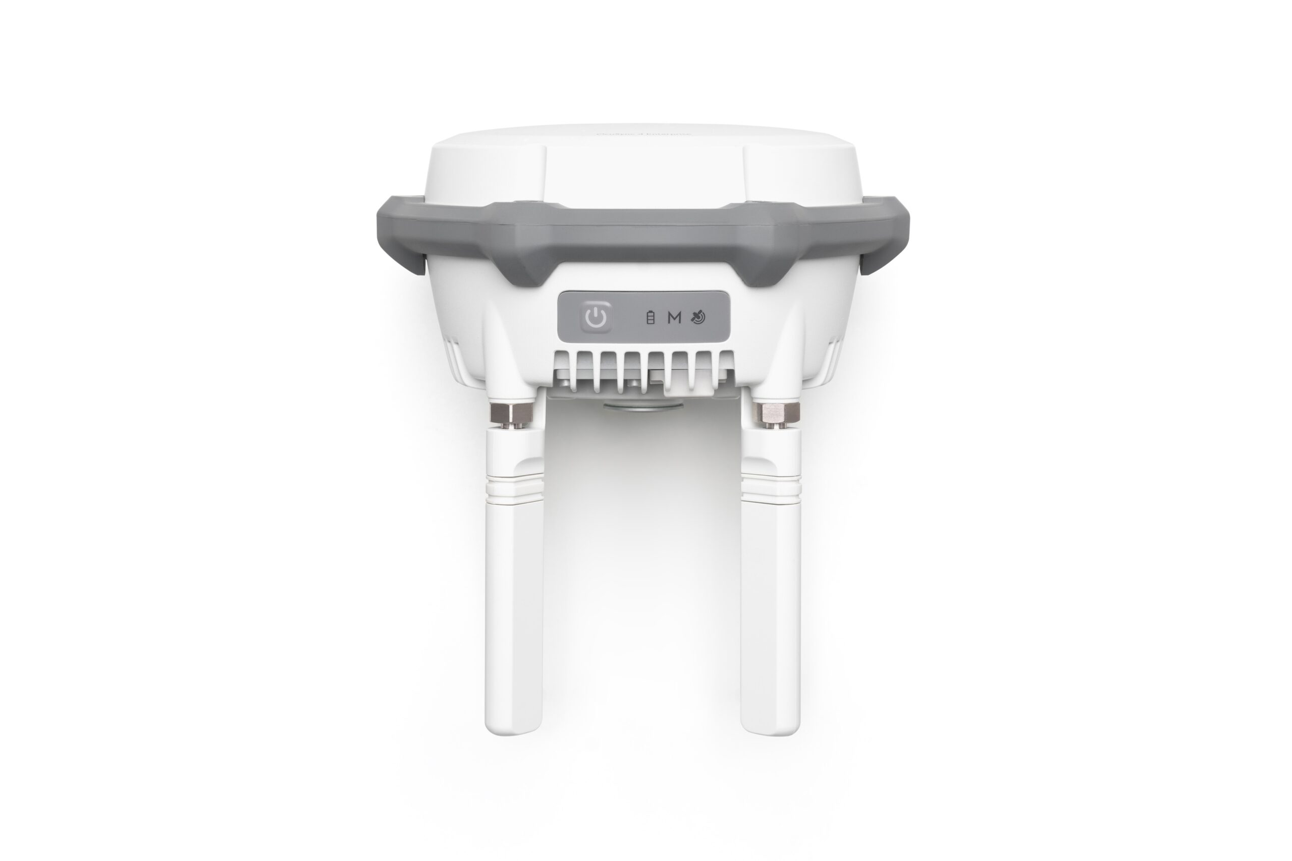
Serves as a base station for centimeter-level positioning of multiple drones simultaneously, or as a relay station to extend drone range.
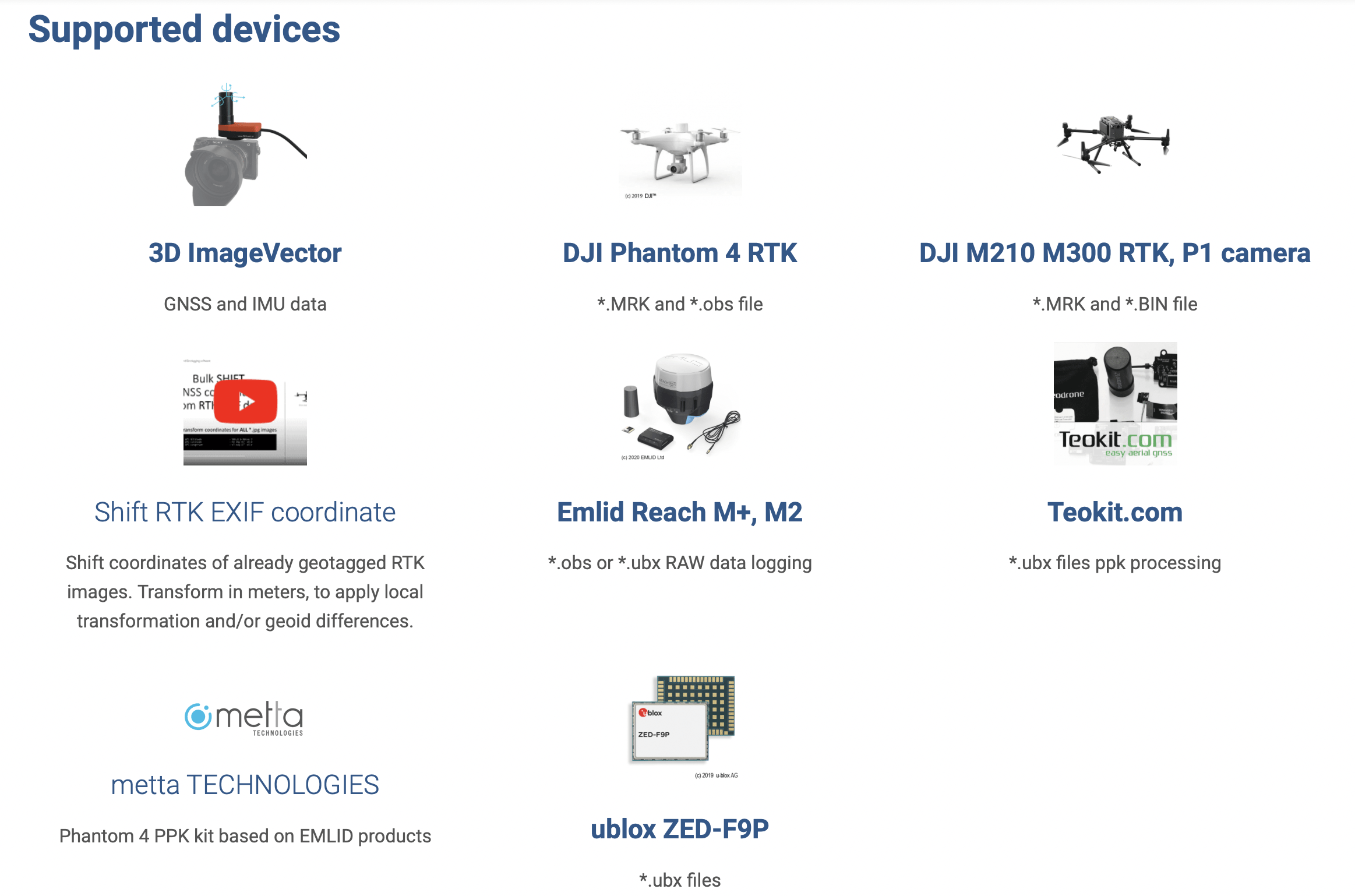
The software performs a multi-constellation (GPS, GLONASS, Beidou, Galileo) and multichannel (L1, L2, L5) GNSS postprocessing PPK of Base-Rover configurations. Such configurations can be found in many UAV / drone applications and terrestrial 3D ImageVector device. The corrected GNSS path accuracy is at centimeter level, depending on the device use, the current satellite constellation and receipt quality.
Triggers are extracted from the path and mapped to images. Outputted as plain Text, as image EXIF data or in native Agisoft, Pix4d and Google Earth files, these information can be used many other fields of applications., eg. in photogrammetry and documentation.
Already have RTK data but discrepancies caused by geoid undulation and local projection?

Serves as a base station for centimeter-level positioning of multiple drones simultaneously, or as a relay station to extend drone range.

Empowers DJI equipment to access 4G networks, enabling connectivity services, Enhanced Transmission, and additional features.

High-bright display. IP54 protection rating. O4 Enterprise video transmission. Support for both SDR and 4G hybrid transmission.

DJI Matrice 400, the enterprise flagship drone platform, boasts an impressive 59-minute flight time, a payload capacity of up to 6 kg, and integrated rotating LiDAR and mmWave radar for power-line-level obstacle sensing. It also supports the O4 Enterprise Enhanced Video Transmission and Airborne Relay Video Transmission, ensuring safer handling and easier operations. Combining Smart Detection with visible and thermal imaging, AR projection, ship-based takeoff/landing, and advanced automation, Matrice 400 excels in emergency response, power inspections, mapping, and AEC.
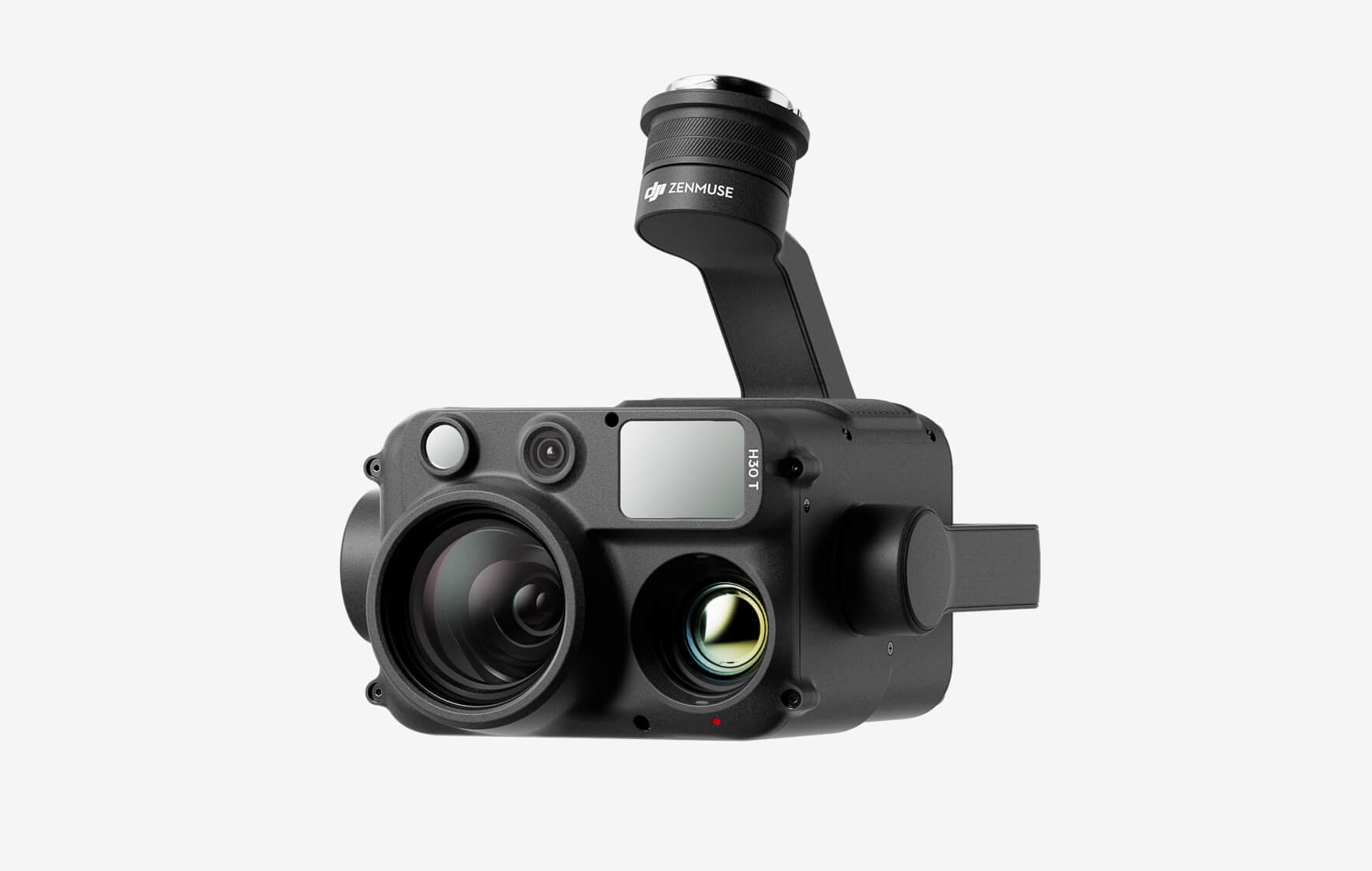
The all-weather, multi-sensor flagship Zenmuse H30 Series integrates five major modules—a wide-angle camera, a zoom camera, an infrared thermal camera, a laser range finder, and an NIR auxiliary light. Employing cutting-edge intelligent algorithms, it revolutionizes perception and imaging standards, transcending the limitations of day and night vision. This makes it effortlessly suitable for a variety of operations, including public safety, energy inspection, water conservation, and forestry.