DJI P4 Multispectral + D-RTK 2 High Precision GNSS Mobile Station Combo

The P4 Multispectral is a fully integrated multispectral imaging drone designed for precision agriculture and environmental
management. Combining data from six separate sensors to measure the health of crops, from individual plants to entire
fields, as well as weeds, insects and a variety of soil conditions, the P4 Multispectral sets a new standard for easy-to-use
agricultural drone applications.

You can order Phantom 4 Pro Multispectral in Dubai, UAE right now
The P4 Multispectral is a fully integrated multispectral imaging drone designed for precision agriculture and environmental
management. Combining data from six separate sensors to measure the health of crops, from individual plants to entire
fields, as well as weeds, insects and a variety of soil conditions, the P4 Multispectral sets a new standard for easy-to-use
agricultural drone applications.
Plant Intelligence for Targeted Action
Gather precise plant-level data using the P4 Multispectral – a high-precision drone with a seamlessly integrated multispectral imaging system built for agriculture missions, environmental monitoring, and more.
Watch Video
Gain Immediate Insights into Plant Health
The P4 Multispectral consolidates the process of capturing data that gives insight into crop health and vegetation management. DJI has created this platform with the same powerful performance standards that DJI is known for, including 27 minutes max flight time and up to 7 kmtransmission range with the OcuSync system.

See Beneath the Surface

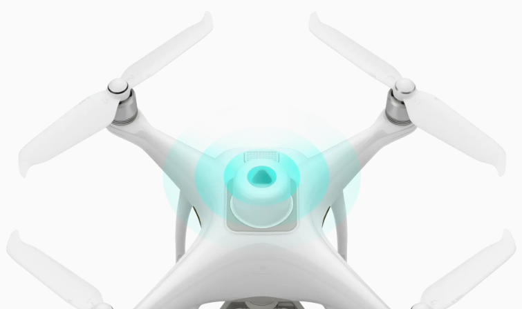
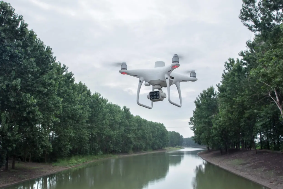
Agriculture imagery collection is now simpler and more efficient than ever before with a built-in stabilized imaging system that collects comprehensive data sets right out of the box. Access information collected by 1 RGB camera and a multispectral camera array with 5 cameras covering Blue, Green, Red, Red Edge, and Near Infrared bands – all at 2 MP with global shutter, on a 3-axis stabilized gimbal.

Integrated Spectral Sunlight Sensor for Accurate Results
An integrated spectral sunlight sensor on top of the drone captures solar irradiance, which maximizes accuracy and consistency of data collection through different times of day. When combined with post-processed data, this information helps to obtain the most accurate NDVI results.

Meaningful Data at Your Disposal

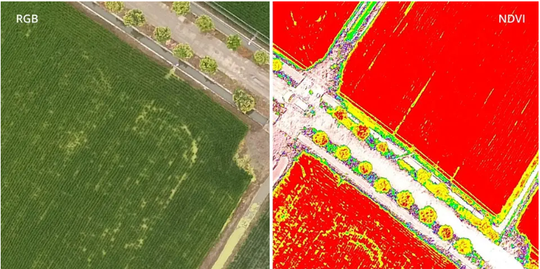
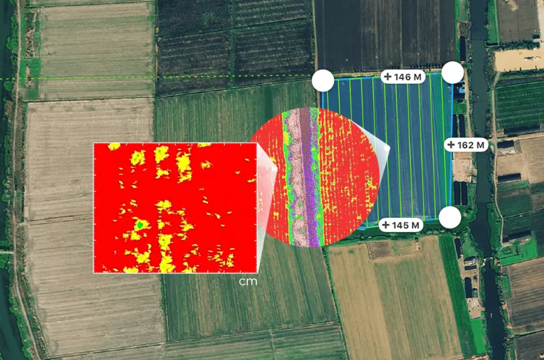
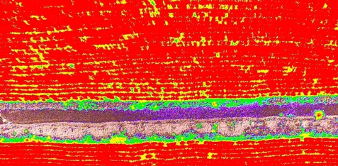
View Both RGB and NDVI Feeds
Simply having aerial imagery is not enough for ag professionals who want to know more. Switch between a preliminary Normalized Difference Vegetation Index (NDVI) analysis and the live RGB feed to immediately visualize where attention is needed, so targeted treatment decisions can be made quickly.

Centimeter-level Precision
Get real-time, accurate positioning data on images captured by all six cameras with DJI’s TimeSync system, providing centimeter-level accurate measurements. The TimeSync system continually aligns the flight controller, RGB and NB cameras, and RTK module, fixing the positioning data to the center of the CMOS and ensuring each photo uses the most accurate metadata. All cameras go through a rigorous calibration process where radial and tangential lens distortions are measured. The distortion parameters gathered are saved into each image’s metadata, letting post-processing software adjust uniquely for every user.

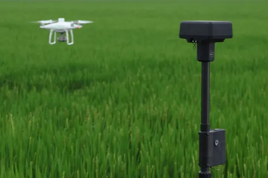
D-RTK 2 Mobile Station and NTRIP Compatibility
Enhance the accuracy of RTK positioning without internet connection by connecting the P4 Multispectral to the D-RTK 2 High Precision GNSS Mobile Station and NTRIP (Network Transport of RTCM via Internet Protocol)2, or store the satellite observation data to be used for Post Processed Kinematics (PPK).

The Beginning of Intelligent Agriculture Missions

Plan Flights

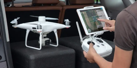
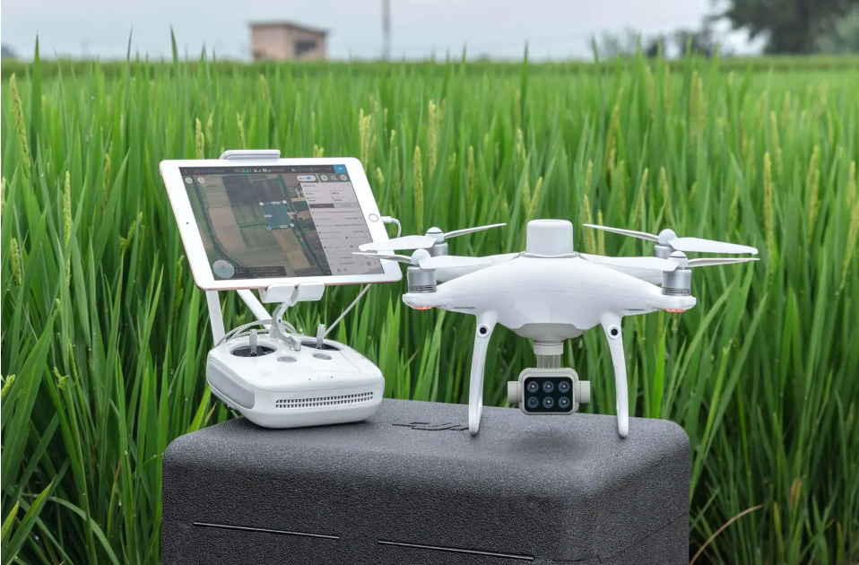
Plan flights, execute automated missions, and manage flight data using GS PRO – DJI’s leading flight planning iOS app.

Capture Data

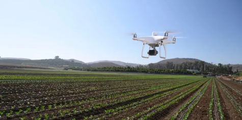
Collect multispectral images efficiently across a large area using the P4 Multispectral and gain an overview of problem areas.

Analyze Data

Easily access and process aerial data by applying plant-specific metrics and parameters to acquire the desired results on plant health.

Act on Data

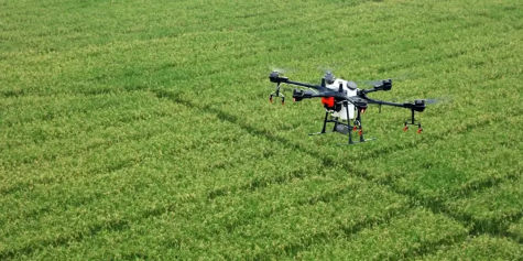
Implement targeted treatments on areas that need attention based on accurate drone data.

Applications

Precision agriculture
Throughout all growing seasons, multispectral imagery can be helpful to ag professionals by providing information invisible to the human eye across the electromagnetic spectrum. Having access to this data and the subsequently obtained Vegetation Index data such as NDRE and NDVI, farmers can make timely, informed decisions on crop treatment, lowering costs, saving resources, and maximizing yields.
Environmental monitoring and inspection
Routine inspections and maintenance involving plants can be made smarter and more efficient when using the P4 Multispectral – leverage its actionable multispectral insights to monitor forest health, measure biomass, map shorelines, or manage riparian vegetation while protecting habitats or ecosystems, and much more.
Key Features
Precise Multispectral Imaging
The built-in stabilized imaging system collects comprehensive sets of data right out of the box. Access information
collected by 1 RGB camera and a multispectral camera array with 5 cameras covering Blue, Green, Red, Red Edge, and
Near Infrared bands – all at 2MP with global shutter, on a 3-axis stabilized gimbal.
Integrated Spectral Sunlight Sensor
An integrated spectral sunlight sensor on top of the drone captures solar irradiance, which maximizes accuracy and
consistency of data collection through different times of day. When combined with post-processed data, this
information helps to obtain the most accurate NDVI results.
Live RGB and NDVI View
Seamless integration into the DJI Ground Station Pro flight planning app allows pilots to switch between real-time views
of the drone’s RGB video camera and Normalized Difference Vegetation Index (NDVI) output for immediate insights
while in the field.
Flight Performance
Pilots using multiple drone payloads during their operations can now calibrate the drone’s new center of gravity with
ease from the DJI Pilot app for better flight performance.
Data Accuracy
An integrated RTK positioning module and TimeSync system support real-time, accurate positioning data for each
image, optimizing photogrammetric results and providing centimeter-level accurate measurements.
Compatible Software
Use DJI Ground Station Pro to create automated and repeatable missions including flight planning, mission execution, and
flight data management. Data collected can be easily imported into DJI Terra, and a suite of third-party software.

Based on 0 reviews

0.0 overall
0
0
0
0
0

Be the first to review “DJI P4 Multispectral + D-RTK 2 High Precision GNSS Mobile Station Combo”

There are no reviews yet.

DJI Zenmuse L2 (LiDAR)
  • High Precision
  • Exceptional Efficiency
  • Superior Penetration
  • 250m/450m Detection Range
  • 5 Returns
  • Turnkey Solution
  • Point Cloud LiveView
  • One-Click Processing on DJI Terra
Buy
M30 PSDK ADAPTER BRACKET

The PSDK load can be fixed to the M30 series flight platform, and different types of PSDK loads can be quickly removed and replaced.

Buy
FC30 EQUIPPED WITH A THREE-LOAD SUPPORT

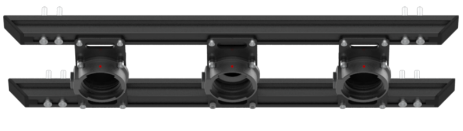
The FC30 EQUIPPED WITH A THREE-LOAD SUPPORT is designed for the DJI FlyCart 30 carrier and can support up to three ET4 FOUR DROP KIT at the same time, achieving 12-stage drops with a maximum payload of 120kg.

Buy

Inquire price for

    ×