GIMBALS, CAMERAS, SENSORS
Showing 46–60 of 101 results
-
GIMBALS, CAMERAS, SENSORS, PAYLOADS SDK
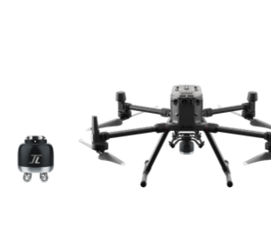
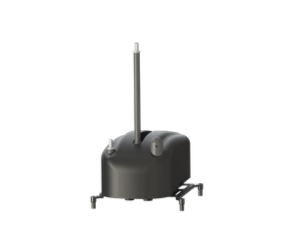
PD4 POWER DROP KIT
PD4 is installed on the Drone of DJI M300RTK. It is able to carry diverse loads and release them to the specific areas. The staff can monitor the live view of scenario while delivering the loads remotely to help with the emergency rescue tasks.
SKU: n/a -
GIMBALS, CAMERAS, SENSORS, PAYLOADS SDK
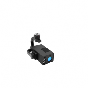
Four In One Corona Camera
It is a combination of UV, infrared, visible light, and laser range finder. It works on DJI enterprise platforms to help discover the potential safety hazards of insulator in time. With the 1: 1 UV and IR synchronous display, the detection of corona and heating can be done simultaneously. Defect identification function can be developed on the powerful built-in processor.
SKU: n/a -
GIMBALS, CAMERAS, SENSORS, PAYLOADS SDK
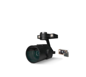
Dual-camera HD Zoom Ai Gimbal Camera
Products developed for high-definition shooting and large zoom needs
Can shoot 20 million pixel high-definition pictures, 1080P video recording, maximum focal length 720mm
At the same time, it has a wide-angle field of view and a zoom field of view for easy target positioning
Built-in high-performance processor, can identify more than 19 types of power transmission line tower targets, complete automatic shooting of power inspection
Support OSDK automatic flight control, you can connect M210 through the gimbal camera for OSDK flightSKU: n/a -
GIMBALS, CAMERAS, SENSORS, PAYLOADS SDK
Single-Line LIDAR
Data is automatically associated with the tower
Automatic tracing of the wire and imitating sag flight
Fully autonomous obstacle avoidance
Real-time detection of wire defects and wire tree distance
Automatically generate defect analysis report
Weight: 324gSKU: n/a -
-
GIMBALS, CAMERAS, SENSORS, PAYLOADS SDK
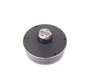
Airborne Spectrum Analyzer
Border and conventional area radio spectrum monitor and and Management ;
Search, location, evidence collection and Law Enforcement Assistance of illegal broadcasting stations;
Testing and finding interference sources for mobile communication network;
Radio collar location tracking and outdoor rescue of wildlife;
Electronic countermeasure.SKU: n/a -
GIMBALS, CAMERAS, SENSORS, PAYLOADS SDK
MS600 PRO Multispectral Camera
6band
Calibration correction
Real-time image transmission: data processing: support Yusense Map, Pix4D offline processing and “end-cloud integration”
Synchronous data upload
Storage/working temperature range: -30°C~+70°C/-10°C~+50°C
Environmental adaptability: sapphire window, scratch-resistant, abrasion-resistant and durableSKU: n/a -
-
GIMBALS, CAMERAS, SENSORS, PAYLOADS SDK
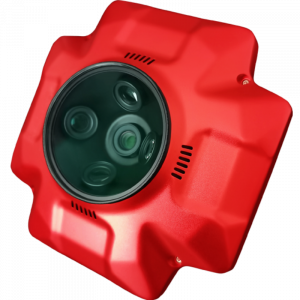
Atmospheric Pollution Detection System
Real-time monitoring of multiple indicators in the air, including PM2.5, PM10, CO, NO2, O3, VOCs, H2S, flammable and explosive, etc. Real-time mapping of pollution, one-click production monitoring report
- Size: 200*125*110mm
- Weight: 500g
- Air intake mode: upper duct pumpsuction type
- Monitoring frequency: 0.5Hz
SKU: n/a -
-
GIMBALS, CAMERAS, SENSORS, PAYLOADS SDK
Sniffer4d V2 Multi-gas Detection System
- Designed to be carried by drones & ground vehicles
- Captures georeferenced & timestamped gas & particle concentrations
- Real-time data transmission via LTE networks
- Multi-gas Detection Hardware
- Up to 9 Parameters at a Time
- Size 157 x 103 x 87mm
- Weight 400 – 500g
SKU: n/a -
GIMBALS, CAMERAS, SENSORS, PAYLOADS SDK
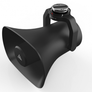
Loudspeaker
Drone speaker. Get your message out with this loud speaker / megaphone with wireless ground-microphone
- Weight: <600g
- Highly integrated, ready to use
- Online text to speech conversion
- Background sound and broadcast content can be played simultaneously
SKU: n/a -
GIMBALS, CAMERAS, SENSORS, PAYLOADS SDK
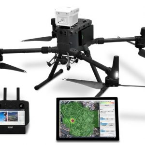
PSDK102S Five-Lens Aerial Oblique Camera
PSDK 102S five-lens aerial oblique camera, designed by SHARE UAV, is a new generation mapping camera can realize drone surveying and mapping with no GCPs used. Camera is seamless docking with DJI Matrice 300 RTK through SkyPort. Using CNC designed housing makes PSDK 102S have better heat dissipation, smaller wind resistance coefficient, stronger structure, which is more conducive to aerial survey flight. Besides, PSDK 102S also has intelligent self-test, one-key reset, intelligent heat dissipation, real-time image transmission and other functions.
SKU: n/a -
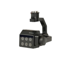
GIMBALS, CAMERAS, SENSORS, PAYLOADS SDK
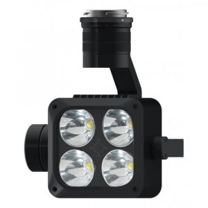
DJI Wingsland Z15 Gimbal Spotlight for Matrice 200 and 200 v2 Series
 GIMBALS, CAMERAS, SENSORS, PAYLOADS SDK
DJI Wingsland Z15 Gimbal Spotlight for Matrice 200 and 200 v2 Series
The Wingsland Z15 is a bright, 3-axis stabilized gimbal spotlight with high power beads. Powered by DJI SkyPort, it has an operating range of up to 150 m and can be easily integrated onto DJI Matrice 200 Series V1 and V2 drones, lighting the space at night or in lowlight conditions for users in firefighting, emergency response, law enforcement and beyond.
SKU: n/a -
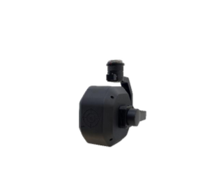
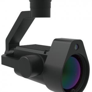
GIMBALS, CAMERAS, SENSORS, PAYLOADS SDK
U10 LASER METHANE LEAKAGE DETECTOR
The U10 is a light-weight, high-sensitivity gas detector based on Tunable Diode Laser Absorption Spectroscopy (TDLAS), which enables rapid identification of methane from up to 100 m away, or at a concentration as low as 5ppm.m. Powered by DJI SkyPort, the U10 can be seamlessly integrated with DJI Matrice 200 Series V1 and V2 platforms.
SKU: n/a